What's new in ArcGIS Drone2Map 2026.1
Some of the new features of ArcGIS Drone2Map 2026.1 are described below.
Processing improvements
The latest improvements in the Drone2Map processing engine offer significantly reduced rapid processing times by introducing a new rapid point cloud density option. This allows quicker results on time sensitive projects such as disaster response, emergency inspections, and construction phase management.
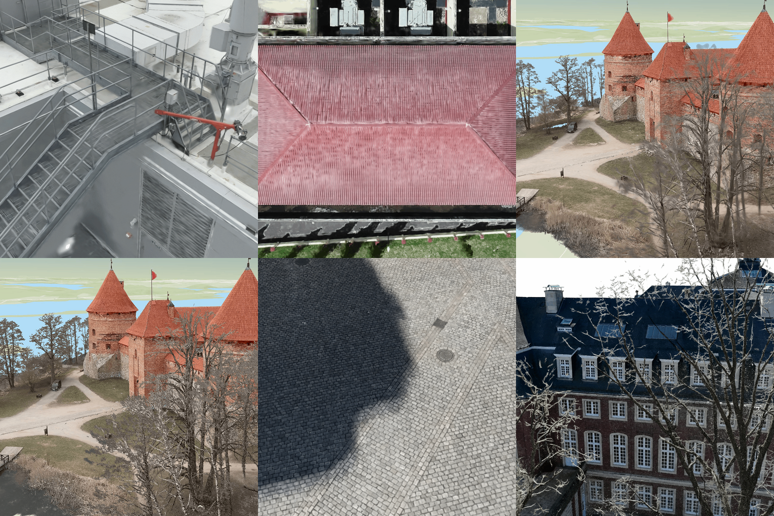
Gaussian splats products now offer faster processing times when working with large datasets. Small details on objects and areas with complex textures are better represented when using the High or Ultra point cloud density settings.
Adjust images can now be configured in two different modes: Standard or Challenging. The new Challenging mode helps to calibrate more images and improve overall adjustment quality by compensating for images with low contrast and texture, sparse manmade features and large areas of vegetation. Standard mode is suitable for most imagery and subject matter, while Challenging mode is intended for drone images captured over homogenous areas such as dense vegetation or waterbodies.
Additional support for some of the latest DJI thermal camera platforms has been added. The following cameras can now be used within Drone2Map to process thermal imagery into thermal true orthos: Dock 3, Zenmuse H30, Zenmuse XT S, Matrice 4.
3D mensuration enhancements
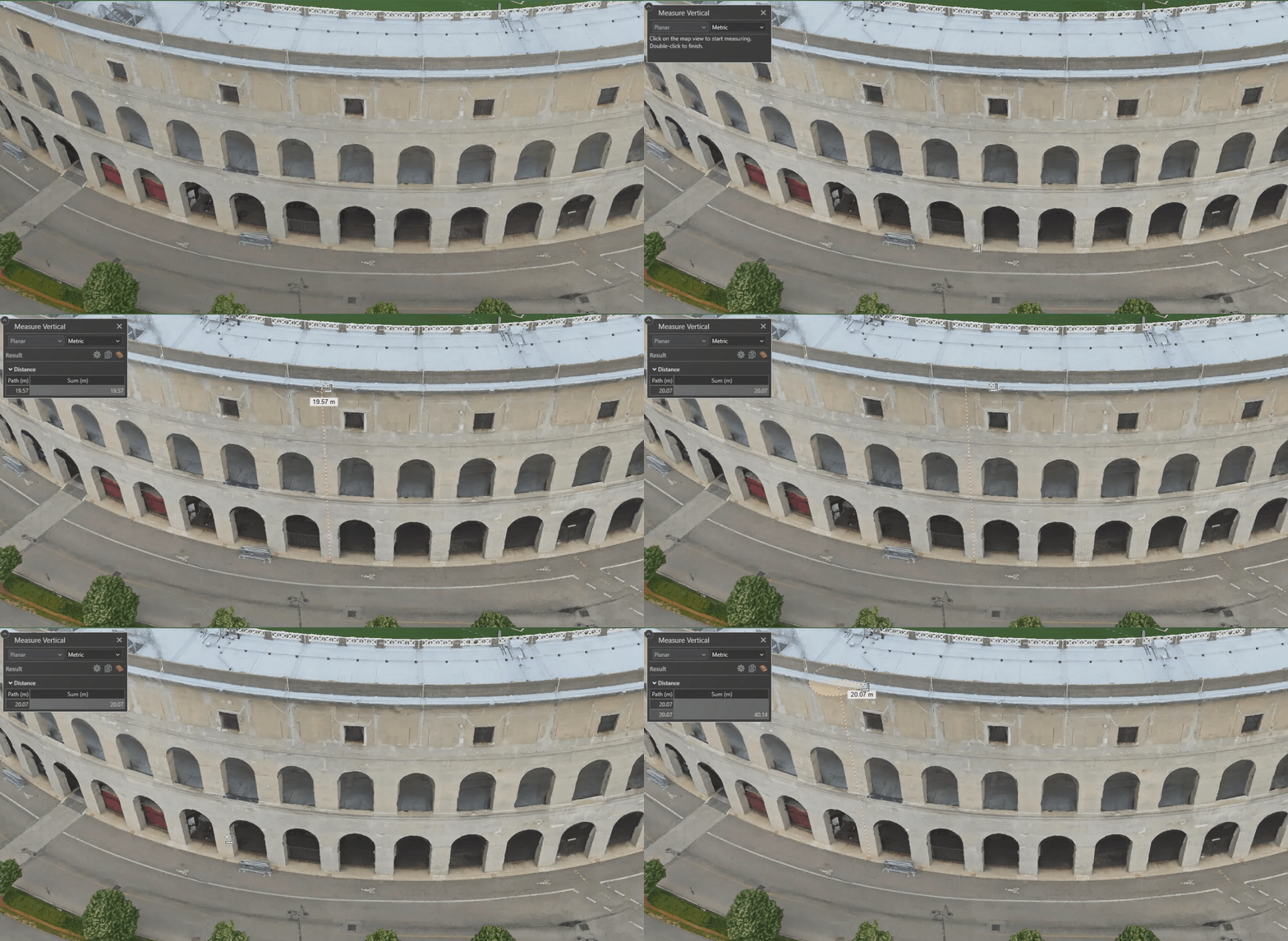
The Measure Vertical tool is now available for use in 3D Maps. This tool allows you to measure an object’s height or vertical difference between two locations. It can be useful when performing inspections in 3D or visualizing the height differences of clustered features.
Expanded output product support
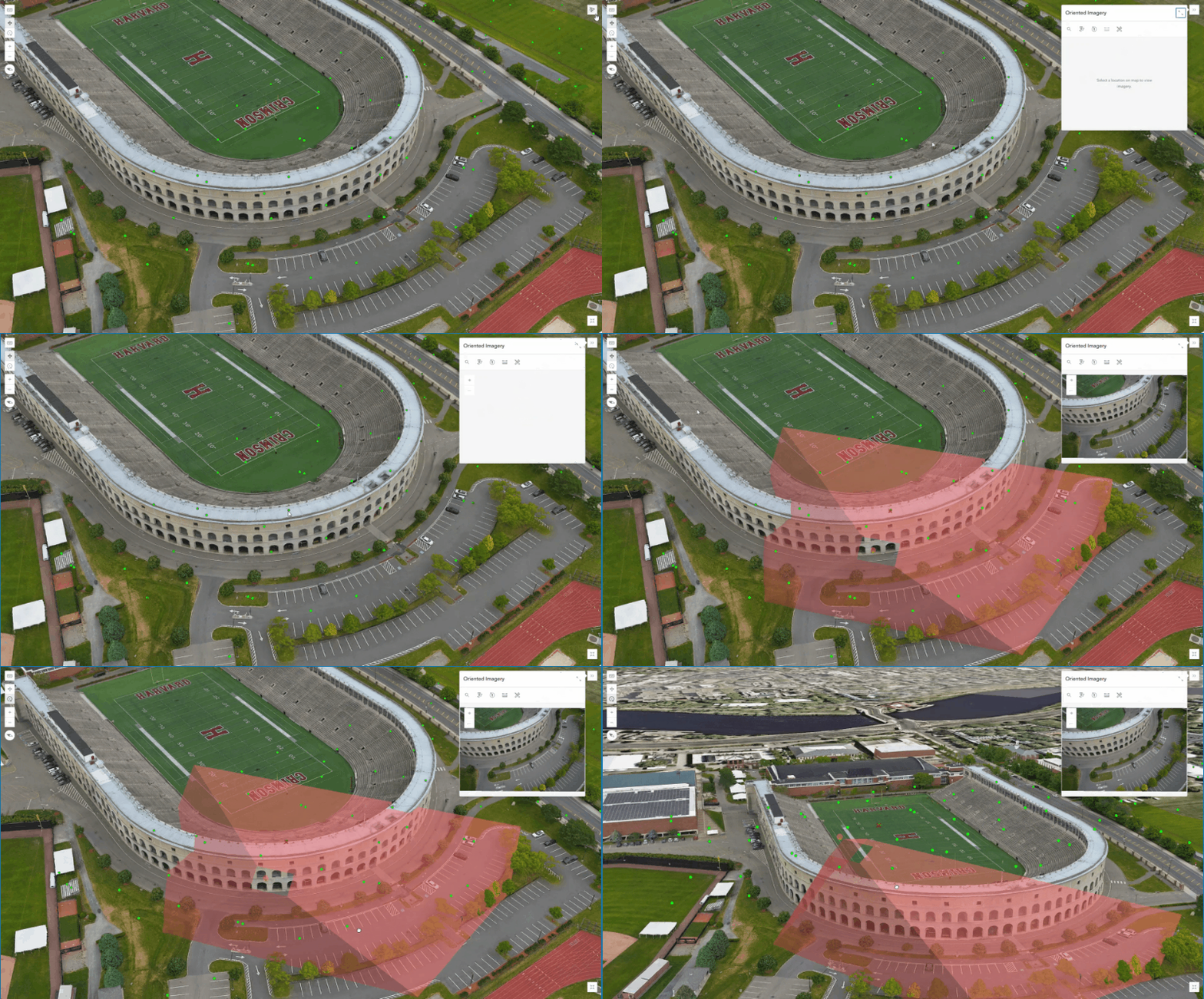
Projects can now be shared as an Oriented Imagery Layer to ArcGIS Online or ArcGIS Enterprise. This can be combined with a 3D Mesh or Gaussian Splat layer within a web scene to offer a highly detailed 3D inspection workspace. Additional options are provided for Oriented Imagery Layers when sharing which allow for further customization.
Merged TIF products can now be generated as the Cloud Optimized GeoTIFF (COG) format by default. A new drop-down menu has been added to the backstage application settings. COG format rasters are designed for efficient cloud-based data access through the use of internal tiling and overviews.
Additionally, two new output raster formats are available for True Ortho, DSM, DTM and Shaded Relief products:
Meta Raster Format (MRF)
Cloud Raster Format (CRF)
These new formats are optimized for cloud storage and web mapping performance compared to TIF outputs. This is particularly helpful when working with very large datasets that take considerable time to load and navigate around.
Licensing update
ArcGIS Drone2Map 2026.1 will move from multiple license levels (Standard and Advanced) to a single Reality Mapping license. This new license will become the way to access ArcGIS Drone2Map, and all its capabilities. As part of this transition, users with Standard licenses will have all Drone2Map Advanced capabilities unlocked under the new Reality Mapping license.
If you are assigned a Professional or Professional Plus user type, the 300 gigapixel limit for Drone2Map projects will no longer be present, allowing for processing of large datasets without having to be split into sub projects.
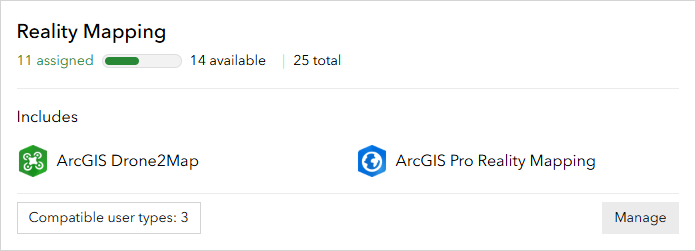
No projects, data, or workflows are impacted as a result of this change. Users can continue working as they do today, with access to more capabilities once the new license is assigned.
In addition to Drone2Map capabilities, the Reality Mapping license also includes access to ArcGIS Reality for ArcGIS Pro, an extension for ArcGIS Pro that allows users to perform reality mapping workflows using drone, aerial, and satellite imagery. These ArcGIS Reality for ArcGIS Pro capabilities are available only to users with Professional or Professional Plus User Types.
Both Drone2Map Standard and Drone2Map Advanced license types will transition differently at renewal.
Ground control improvements
Auto link detection performance has been improved by more than 30% while maintaining a high level of accuracy. The largest time reduction benefits will be seen on large projects with a high number of ground control points being detected.
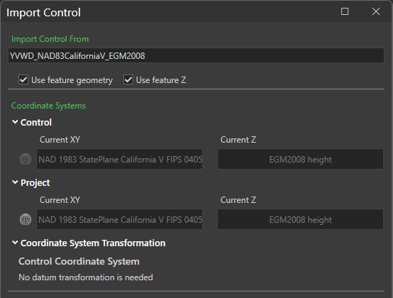
The import process for ground control points that use a geographic coordinate system has been updated to allow the specification of any project coordinate system rather than automatically default to the nearest UTM zone. This helps save time by eliminating the need for any reprojection of products. If a transformation is needed, this can now also be applied within the same section.
Additional project management capabilities
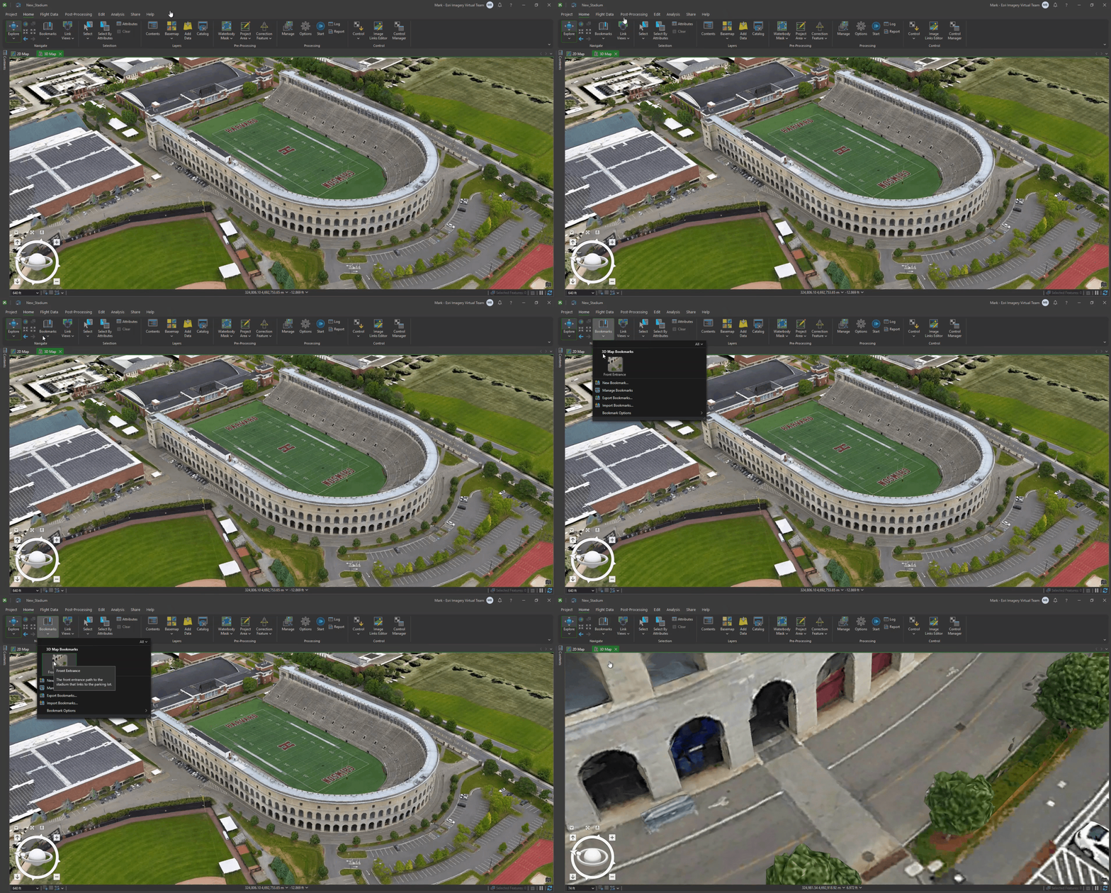
Bookmarks are now supported by Drone2Map and allow for the creation of quick map references at various scales and orientations. They can be configured with labels and store hyperlinks within their descriptions. Any bookmarks created within Drone2Map will be carried over into ArcGIS Pro if using the Open in ArcGIS Pro functionality.
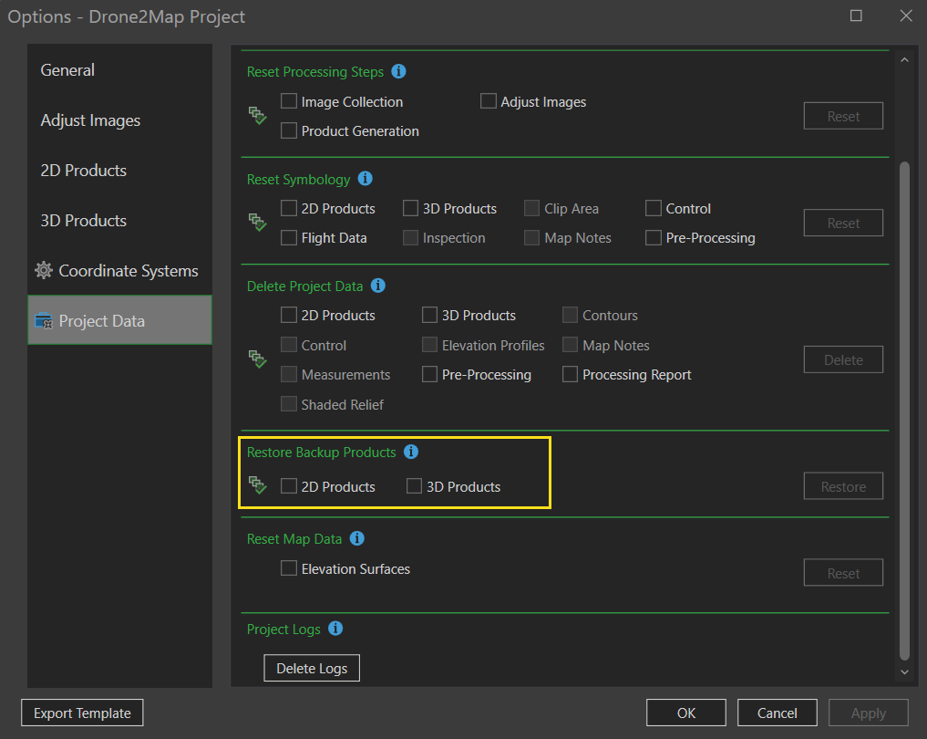
The ability to restore backed up products has been added to projects. These options allow you to restore output products to their original state. If more than one backup exists, the original product for the project will be restored. For workflows making use of re-processing, these options help provide stability by eliminating the need to recreate projects.
Enhanced product support
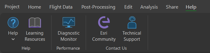
Drone2Map 2026.1 introduces a new help tab allowing you easy access to documentation, performance tools and product support.
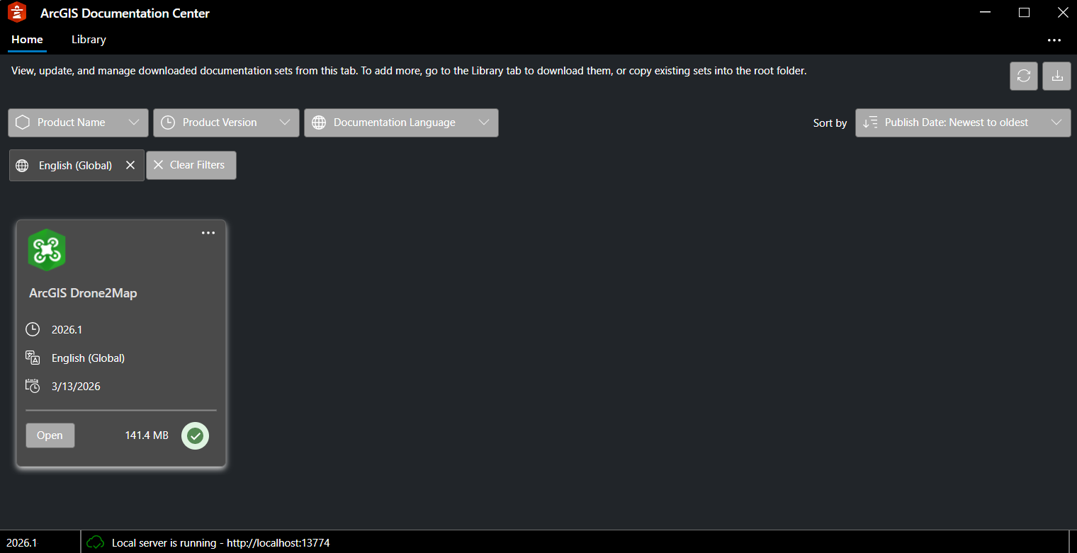
Offline documentation capabilities have been upgraded through the introduction of a new ArcGIS Documentation Center application. This application allows you to download and reference the latest help documentation offline, but still view it in the same user interface as the web. Older versions of help documentation and different supported languages can also be downloaded into ArcGIS Documentation Center so they can be easily accessed in one place.
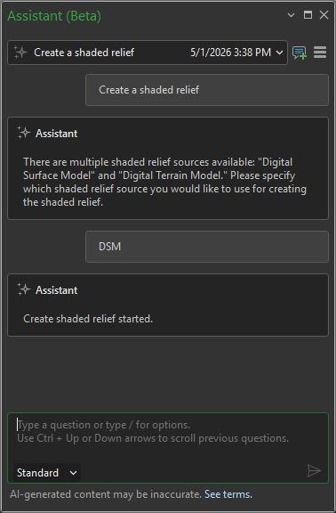
AI Assistant
A new AI Assistant is being tested for Drone2Map within an Early Adopter Community beta program. The assistant allows you to quickly query documentation and automate various workflows within a project. To learn more about the beta see: ArcGIS Drone2Map AI Assistant Beta