Edit feature services
 Available with the Linear Referencing license.
Linear referencing system (LRS) data published as feature services (also called web feature layers) with branch versioning can be edited by other users in your organization using the multiuser editing tools in ArcGIS Pro. Before editing, create a named version from the default version.
Access to published feature services requires portal credentials.
Note:
If the feature service isn't yet published, see Share as web layers.
Before editing a feature service, complete the following steps:
In ArcGIS Pro, sign in to an ArcGIS Enterprise portal.
Your ArcGIS Server site must be federated with ArcGIS Enterprise.
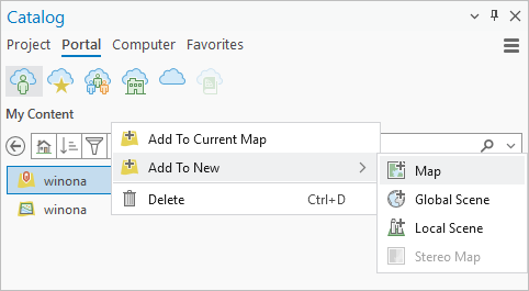
In the Catalog pane, click the Portal tab, and under My Content, right-click the feature service and click Add To New > Map.
Tip:
You can also search and add editable feature services that have been shared with you in My Groups
 and ArcGIS Enterprise
 .
To add a specific layer in a feature service, double-click the service to show all the layers, and choose the specific layer to add to the map.
In the Contents pane, click List By Data Source
 and click the feature service layer.
The contextual Versioning tab appears.
Note:
When you add a feature service to a map, it is added using the default version.
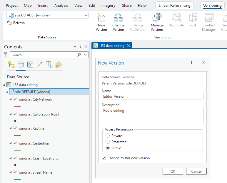
On the Versioning tab, in the Versioning group, click New Version
 .
The New Version dialog box appears.
Note:
With branch versioned data, you can only create new named versions from the default version.
Provide a name for the new named version in the Name text box.
Optionally, provide a description for the named version in the Description text box.
Choose from the following access levels for the named version:
Private—Only the owner or the geodatabase administrator can access the version and modify it and the versioned data.
Protected—Any user can access the version, but only the owner or the geodatabase administrator can edit the version and the datasets in it.
Public—Any user can access the version. Any user who has been granted read/write (update, insert, and delete) permissions on datasets can modify datasets in the version.
Check the Change to this new version check box to switch to the named version after it is created.
Click OK.
The named version is created. If the Change to this new version check box is checked, the named version is shown in the Data Source list in the Contents pane.
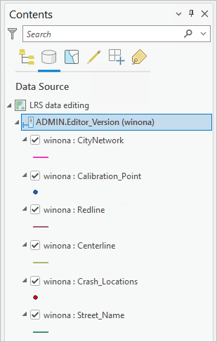
Optionally, right-click the feature service layer in the Data Source list and click Change Version to switch to a named version.
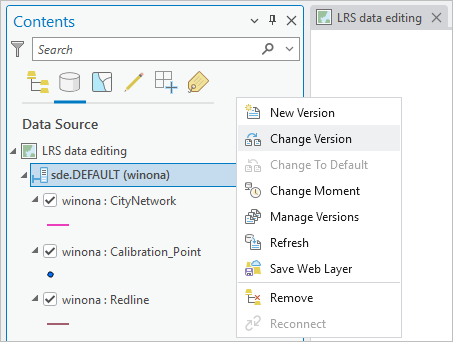
Ensure that the named version appears in the Data Source list before making edits.
Caution:
Edits to the default version are permanent and cannot be undone, redone, saved, or discarded.
Multiple editors can edit the feature service in separate named versions. Branch versioning allows only one editor per named version or multiple readers.
Once an editor begins editing in a named version, do not access the same version in multiple maps, ArcGIS Pro instances, or ArcGIS Pro and Experience Builder simultaneously.
You can now edit the feature service in a named version.