Multiple linear referencing methods
 Available with the Linear Referencing license.
Managing historical pipeline records is complex because teams may need to represent pipelines and assets in multiple measurement systems, including engineering stationing, continuous measures, and mileposts.
Managing historical roadway records is complex because teams may need to represent roads and assets in multiple measurement systems, including continuous measures and mileposts.
ArcGIS Linear Referencing supports multiple measurement systems by allowing you to create multiple networks in a single linear referencing system (LRS). The foundation of an LRS is built on the centerline, and networks (a collection of routes) are built using the geometry of the centerline. Each network can have a different unit of measure. You can register events with the network to describe the assets.
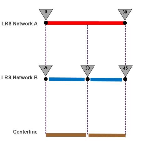
Each business unit (engineering, survey, operation, and maintenance) may have its own network that depicts how its pipelines or roads are subdivided and measured. Similarly, event data may also be collected against multiple networks. For event data to be useful, transformations among all the measurement systems must be feasible. An LRS that supports multiple measurement systems improves measure transformation, reporting, and analysis for pipeline or road assets.