Manage mission content
Note:
ArcGIS Reality Web App is a beta feature at ArcGIS Enterprise 12.2. While in beta, this capability may not be feature complete and, as such, may have known performance or quality issues and will not be supported by Esri Technical Support.
Feedback on this feature can be provided through the Esri Early Adopter Community.
The mission content page provides a workspace for visualizing, exploring and managing layers associated with a mission.
The content page contains the layer pane and the map viewer. The layer pane lists all layers associated with the mission including images, GCPs, products generated from mission processing and reference layers added by users. The map viewer provides 2D and 3D mode option for visualizing and exploring the layers.
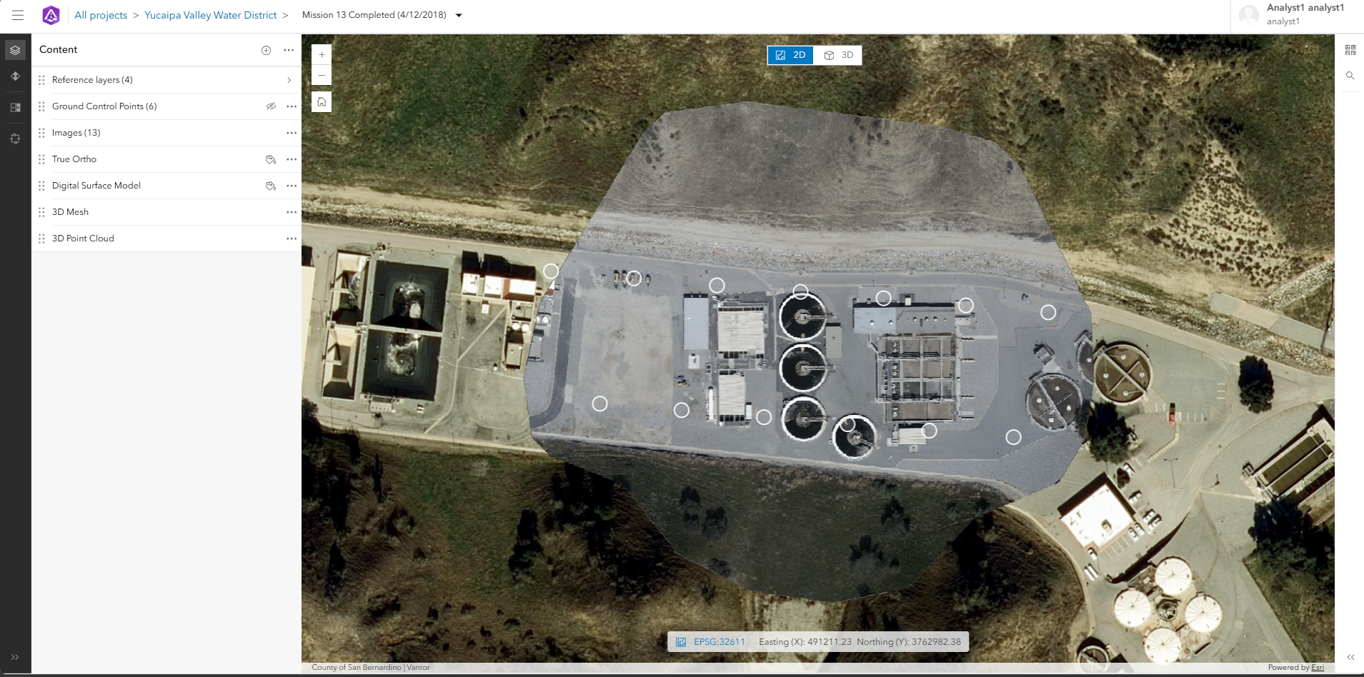
Layer management or exploration tasks that can be done include:
Add layers: Layers can be added from items in ArcGIS enterprise or online, or from URL.
Reorder layers: The display order of the layer can be changed by moving layers up or down accordingly.
Toggle visibility: Each layer has a visibility control for turning the layer on/off. The visibility control for 3D products is available when the 3D view mode is active.
Modify symbology: The appearance of supported 2D product layers can be customized using the symbology option.
More options: Each layer has a more option (...) for additional options such as zooming to the layer, viewing the item details, open in map viewer, removing the layer and analysis options such as hillshade, contours, cut fill and slope for 2D products.