South America
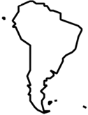
Esri provides South American regional datasets. These include the following:
All listed countries or regions—Esri provides standard demographics datasets sourced from data supplied by Michael Bauer Research GmbH. These datasets are updated every two years. Standard demographics contain general information about a region, such as population counts, household size, educational attainment, and other demographic statistics.
Colombia and Ecuador—In addition to the standard demographics datasets, Esri provides advanced demographics datasets for Colombia and Ecuador. These datasets are updated at various intervals; they typically include additional attributes and more detailed levels of geography.
Esri's regional datasets can be used as a fundamental base for data calculations and business analysis; visit the individual country pages to learn more.
Standard demographics
The table lists the South American countries or regions with standard demographics in the following data categories.
| Country | Age | Education | Households | Income | Jobs | Key Facts | Marital Status | Population | Spending |
|---|---|---|---|---|---|---|---|---|---|
| Argentina |  |
|
|
|
|
|
|
|
|
| Bolivia | |
|
|
|
|
|
|
|
|
| Brazil | |
|
|
|
|
|
|
|
|
| Chile | |
|
|
|
|
|
|
|
|
| Colombia ¹ | |
|
|
|
|
|
|
|
|
| Ecuador ¹ | |
|
|
|
|
|
|
||
| French Guiana | |
|
|
|
|
|
|
||
| Guyana | |
|
|
|
|
||||
| Paraguay | |
|
|
|
|
||||
| Peru | |
|
|
|
|
|
|
||
| Uruguay | |
|
|
|
|
|
|
|
|
| Venezuela | |
|
|
|
|
|
|
Note:
¹ Advanced demographics are also available.
Advanced demographics
Esri provides advanced demographics for Colombia and Ecuador in the following data categories in addition to the standard demographics listed previously.
| Data category | Colombia | Ecuador |
|---|---|---|
| Age | |
|
| Education | |
|
| Households | |
|
| Income | |
|
| Marital Status | |
|
| Population | |
|
| Spending | |
|