2D and 3D maps
In Drone2Map, you can create and view ground georeferenced 2D and 3D products in maps. Depending on the products that are enabled for processing, they will automatically appear in either a 2D or 3D map. Each map has specific differences in functionality and capabilities.
2D map
The 2D map view is recommended when working with True Orthos, elevation products, and raster editing tools. It is the default view for projects when they are first created.
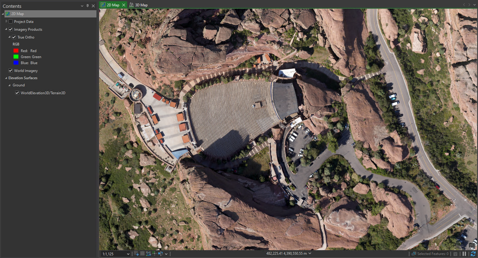
The table below provides an overview of what types of products can be added to the 2D map and examples on their usage.
|
Products |
Example usage |
|---|---|
|
|
You can use these for the following tasks:
Visualization and display—2D maps offer specific 2D basemaps allowing for further customized display of products.
Navigation—Panning and zooming on a 2D map is always done from a nadir perspective, allowing you to analyze features within products such as True Orthos.
Editing—In a 2D map view, specific feature layers can be edited and raster layers can be manipulated to create new outputs or to edit existing layers. Preprocessing features can also be applied to improve areas with low detail.
Measurements and analysis—You can perform mensuration on elevation products. You can also investigate data further through tools such as spectral and elevation profiles, vegetation and soil indices, or inspection workflows.
Data management—You can manage and organize data by adding, removing, reordering, and grouping layers in the Contents pane. You can also view the attribute table associated with the data.
3D map
The 3D map view is recommended when visualizing your flight data in 3D as well as viewing products such as SLPK point clouds, 3D textured meshes, and Gaussian splats from multiple angles.
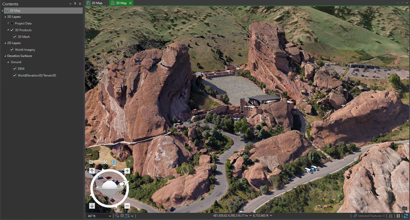
The table below provides an overview of what types of products can added to the 3D map and some example uses.
|
Products |
Example usage |
|---|---|
|
|
You can use these for the following tasks:
Visualization and display—3D map views in Drone2Map can display imagery with elevation and height properties with a customizable display of products.
Navigation—You can navigate 3D map views in first-person perspective through the scene.
Editing—3D map views allow for preprocessing and postprocessing editing.
Measurements and analysis—3D map views allow for vertical measurements between two locations or to measure height.
Data management—The 3D map view, similarly to the 2D map view, allows you to manage and organize data in the Contents pane and view the attribute table associated with the project data.
Work in 2D and 3D map views
Drone2Map allows you to open 2D and 3D map views side by side and link them within the same project. Navigation and selection also become linked, so that selecting a feature in the 2D map highlights it in the 3D map, allowing you to jump between views. You can identify an asset in 2D, and rotate and tilt the 3D view without switching projects or reloading data.
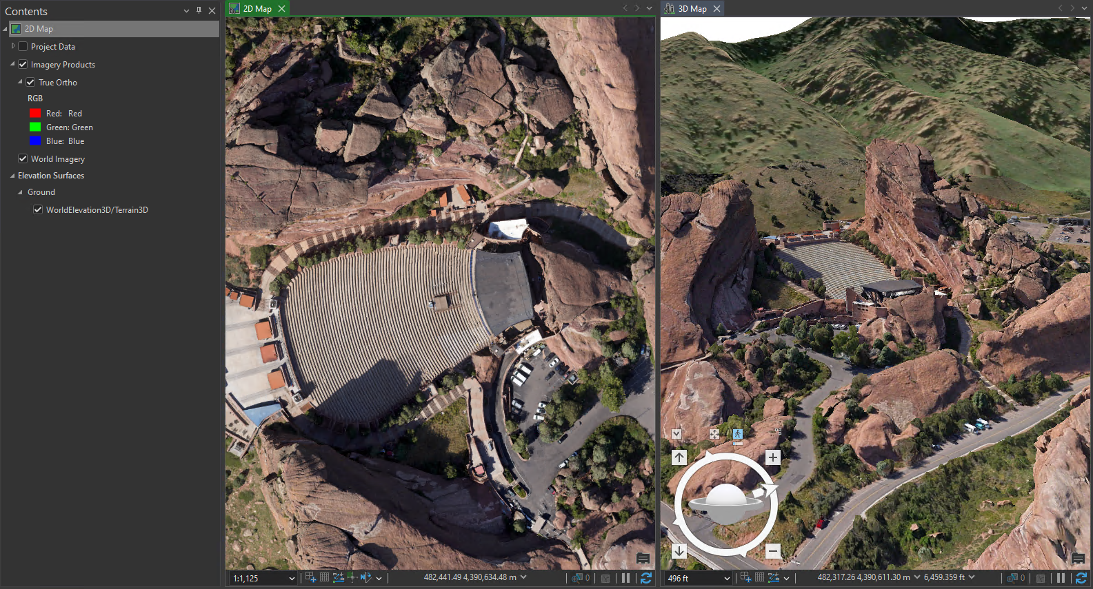
For information on navigating in 2D and 3D, see Navigation.