FeatureLayerCreationParams Class
In This Topic
Represents an object to initialize and create a feature layer with pre-defined properties such as renderer, visibility, definition query etc..
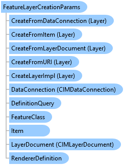
Object Model
Syntax
Public Class FeatureLayerCreationParams
   Inherits LayerCreationParams
public class FeatureLayerCreationParams : LayerCreationParams
Example
Create layer with create-params
{
    var flyrCreatnParam = new FeatureLayerCreationParams(new Uri(@"c:\data\world.gdb\cities"))
    {
        Name = "World Cities",
        IsVisible = false,
        MinimumScale = 1000000,
        MaximumScale = 5000,
        DefinitionQuery = new DefinitionQuery(whereClause: "Population > 100000", name: "More than 100k"),
        RendererDefinition = new SimpleRendererDefinition()
        {
            SymbolTemplate = SymbolFactory.Instance.ConstructPointSymbol(
       CIMColor.CreateRGBColor(255, 0, 0), 8, SimpleMarkerStyle.Hexagon).MakeSymbolReference()
        }
    };
    //Note: Needs QueuedTask to run
    var featureLayerWithParams = LayerFactory.Instance.CreateLayer<FeatureLayer>(flyrCreatnParam, map);
}
Create FeatureLayer and set to not display in Map.
{
    //The catalog path of the feature layer to add to the map
    var featureClassUriVisibility = new Uri(@"C:\Data\Admin\AdminData.gdb\USA\cities");
    //Define the Feature Layer's parameters.
    var layerParamsVisibility = new FeatureLayerCreationParams(featureClassUriVisibility)
    {
        //Set visibility
        IsVisible = false,
    };
    //Create the layer with the feature layer parameters and add it to the active map
    //Note: Needs QueuedTask to run
    var createdFC = LayerFactory.Instance.CreateLayer<FeatureLayer>(layerParamsVisibility, MapView.Active.Map);
}
Create FeatureLayer with a Renderer
{
    //Define a simple renderer to draw the Point US Cities feature class.
    var simpleRender = new SimpleRendererDefinition
    {
        SymbolTemplate = SymbolFactory.Instance.ConstructPointSymbol(ColorFactory.Instance.RedRGB, 4.0, SimpleMarkerStyle.Circle).MakeSymbolReference()

    };
    //The catalog path of the feature layer to add to the map
    var featureClassUri = new Uri(@"C:\Data\Admin\AdminData.gdb\USA\cities");
    //Define the Feature Layer's parameters.
    var layerParams = new FeatureLayerCreationParams(featureClassUri)
    {
        //Set visibility
        IsVisible = true,
        //Set Renderer
        RendererDefinition = simpleRender,
    };
    //Create the layer with the feature layer parameters and add it to the active map
    //Note: Needs QueuedTask to run
    var createdFCWithRenderer = LayerFactory.Instance.CreateLayer<FeatureLayer>(layerParams, MapView.Active.Map);
}
Create FeatureLayer with a Query Definition
{
    //The catalog path of the feature layer to add to the map
    var featureClassUriDefinition = new Uri(@"C:\Data\Admin\AdminData.gdb\USA\cities");
    //Define the Feature Layer's parameters.
    var layerParamsQueryDefn = new FeatureLayerCreationParams(featureClassUriDefinition)
    {
        IsVisible = true,
        DefinitionQuery = new DefinitionQuery(whereClause: "STATE_NAME = 'California'", name: "CACities")
    };
    //Note: Needs QueuedTask to run
    //Create the layer with the feature layer parameters and add it to the active map
    var createdFCWithQueryDefn = LayerFactory.Instance.CreateLayer<FeatureLayer>(layerParamsQueryDefn, MapView.Active.Map);
}
Inheritance Hierarchy
System.Object
ArcGIS.Desktop.Mapping.BaseCreationParams
ArcGIS.Desktop.Mapping.MapMemberCreationParams
ArcGIS.Desktop.Mapping.LayerCreationParams
ArcGIS.Desktop.Mapping.FeatureLayerCreationParams
Requirements
Target Platforms: Windows 11 Home, Pro, Enterprise (64 bit)
ArcGIS Pro version: 3.0 or higher.
See Also