LinearUnit Class
In This Topic
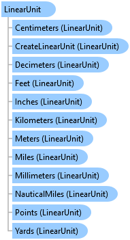
Represents a linear unit of measure used by a Geometry or SpatialReference, or in measurement conversion functions.
Object Model
Syntax
Remarks
The available linear units of measure.
| Factory Code | Unit Name |
|---|---|
| 9001 | International meter |
| 9002 | International foot |
| 9003 | US survey foot |
| 9005 | Clarke's foot |
| 9014 | Fathom |
| 9030 | International nautical mile |
| 9031 | German legal meter |
| 9033 | US survey chain |
| 9034 | US survey link |
| 9035 | US survey mile |
| 9036 | Kilometer |
| 9037 | Yard (Clarke's ratio) |
| 9038 | Chain (Clarke's ratio) |
| 9039 | Link (Clarke's ratio) |
| 9040 | Yard (Sears) |
| 9041 | Sear's foot |
| 9042 | Chain (Sears) |
| 9043 | Link (Sears) |
| 9050 | Yard (Benoit 1895 A) |
| 9051 | Foot (Benoit 1895 A) |
| 9052 | Chain (Benoit 1895 A) |
| 9053 | Link (Benoit 1895 A) |
| 9060 | Yard (Benoit 1895 B) |
| 9061 | Foot (Benoit 1895 B) |
| 9062 | Chain (Benoit 1895 B) |
| 9063 | Link (Benoit 1895 B) |
| 9070 | Foot (1865) |
| 9080 | Indian geodetic foot |
| 9081 | Indian foot (1937) |
| 9082 | Indian foot (1962) |
| 9083 | Indian foot (1975) |
| 9084 | Indian yard |
| 9085 | Indian yard (1937) |
| 9086 | Indian yard (1962) |
| 9087 | Indian yard (1975) |
| 9093 | Statute mile |
| 9094 | Gold Coast foot |
| 9095 | British foot (1936) |
| 9096 | International yard |
| 109002 | US survey yard |
| 109003 | International Chain |
| 109004 | International Link |
| 109005 | Decimeter |
| 109006 | Centimeter |
| 109007 | Millimeter |
| 109008 | International inch |
| 109009 | US survey inch |
| 109010 | International rod |
| 109011 | US survey rod |
| 109012 | US nautical mile (pre 1954) |
| 109013 | UK nautical mile (pre 1970) |
| 109016 | Point |
| 109030 | 50 kilometer length |
| 109031 | 150 kilometer length |
| 109406 | US square foot |
Example
Create a new layout using a modified CIM and open it
{
  //Create a new layout using a modified CIM and open it.
  //The CIM exposes additional members that may not be
  //available through the managed API.
  //In this example, optional guides are added.
  //Create a new CIMLayout on the worker thread

  //Note: Needs QueuedTask to run
  //Set up a CIM page
  CIMPage newPage = new CIMPage
  {
    //required parameters
    Width = 8.5,
    Height = 11,
    Units = LinearUnit.Inches,

    //optional rulers
    ShowRulers = true,
    SmallestRulerDivision = 0.5,

    //optional guides
    ShowGuides = true
  };
  CIMGuide guide1 = new CIMGuide
  {
    Position = 1,
    Orientation = Orientation.Vertical
  };
  CIMGuide guide2 = new CIMGuide
  {
    Position = 6.5,
    Orientation = Orientation.Vertical
  };
  CIMGuide guide3 = new CIMGuide
  {
    Position = 1,
    Orientation = Orientation.Horizontal
  };
  CIMGuide guide4 = new CIMGuide
  {
    Position = 10,
    Orientation = Orientation.Horizontal
  };

  List<CIMGuide> guideList = new List<CIMGuide>
  {
    guide1,
    guide2,
    guide3,
    guide4
  };
  newPage.Guides = guideList.ToArray();

  //Construct the new layout using the customized cim definitions
  var layout_local = LayoutFactory.Instance.CreateLayout(newPage);
  layout_local.SetName("New 8.5x11 Layout");

  //Open new layout on the GUI thread
  await ProApp.Panes.CreateLayoutPaneAsync(layout_local);

}
Create a new spatial map series
{
  // This example create a new spatial map series and then applies it to the active layout. This will automatically
  // overwrite an existing map series if one is already present.
  //Note: Must be on QueuedTask.Run;
  //SpatialMapSeries constructor - required parameters
  BasicFeatureLayer indexLyr = map.FindLayers("Countries").FirstOrDefault() as BasicFeatureLayer;
  SpatialMapSeries SMS = MapSeries.CreateSpatialMapSeries(layout, mapFrame, indexLyr, "Name");

  //Set optional, non-default values
  SMS.CategoryField = "Continent";
  SMS.SortField = "Population";
  SMS.ExtentOptions = ExtentFitType.BestFit;
  SMS.MarginType = ArcGIS.Core.CIM.UnitType.PageUnits;
  SMS.MarginUnits = ArcGIS.Core.Geometry.LinearUnit.Centimeters;
  SMS.Margin = 1;
  SMS.ScaleRounding = 1000;
  layout.SetMapSeries(SMS);  //Overwrite existing map series.
}
Create report
{
  //Note: Call within QueuedTask.Run()
  //The fields in the datasource used for the report
  //This uses a US Cities dataset
  var listFields = new List<CIMReportField> {
          //Grouping should be the first field
          new CIMReportField{Name = "STATE_NAME", FieldOrder = 0, Group = true, SortInfo = FieldSortInfo.Desc}, //Group cities using STATES
          new CIMReportField{Name = "CITY_NAME", FieldOrder = 1},
          new CIMReportField{Name = "POP1990", FieldOrder = 2, },
      };
  //Definition query to use for the data source
  var defQuery = "STATE_NAME LIKE 'C%'";
  //Define the Datasource
  var reportDataSource = new ReportDataSource(featureLayer, defQuery, listFields);
  //The CIMPage defintion - page size, units, etc
  var cimReportPage = new CIMPage
  {
    Height = 11,
    StretchElements = false,
    Width = 6.5,
    ShowRulers = true,
    ShowGuides = true,
    Margin = new CIMMargin { Bottom = 1, Left = 1, Right = 1, Top = 1 },
    Units = LinearUnit.Inches
  };

  //Report template
  var reportTemplates = await ReportTemplateManager.GetTemplatesAsync();
  var reportTemplate = reportTemplates.Where(r => r.Name == "Attribute List with Grouping").First();

  //Report Styling
  var reportStyles = await ReportStylingManager.GetStylingsAsync();
  var reportStyle = reportStyles.Where(s => s == "Cool Tones").First();

  //Field Statistics
  var fieldStatisticsList = new List<ReportFieldStatistic> {
          new ReportFieldStatistic{ Field = "POP1990", Statistic = FieldStatisticsFlag.Sum}
          //Note: NoStatistics option for FieldStatisticsFlag is not supported.
      };
  var newReport = ReportFactory.Instance.CreateReport("USAReport", reportDataSource, cimReportPage, fieldStatisticsList, reportTemplate, reportStyle);
}
Inheritance Hierarchy
System.Object
ArcGIS.Core.Geometry.Unit
ArcGIS.Core.Geometry.LinearUnit
Requirements
Target Platforms: Windows 11 Home, Pro, Enterprise (64 bit)
ArcGIS Pro version: 3.0 or higher.
See Also