Surface Aspect (3D Analyst Tools)
Summary
Creates polygon features that represent aspect measurements derived from a TIN, terrain, or LAS dataset surface.
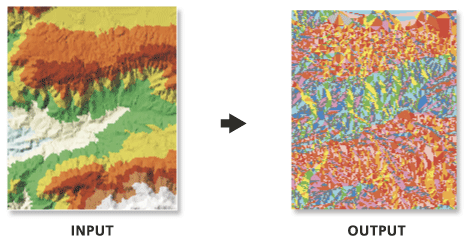
Illustration
Usage
Aspect represents the horizontal orientation of a surface and is determined in units of degrees. Each facet of the surface is assigned a code value which represents the cardinal or ordinal direction of its slope, and contiguous areas with the same code are merged into one feature. The default classification scheme is defined as follows:
Code
Slope Direction
Slope Angle Range
-1
Flat
No Slope
1
North
0° – 22.5°
2
Northeast
22.5° – 67.5°
3
East
67.5° – 112.5°
4
Southeast
112.5° – 157.5°
5
South
157.5° – 202.5°
6
Southwest
202.5° – 247.5°
7
West
247.5° – 292.5°
8
Northwest
292.5° – 337.5°
9
North
337.5° – 360°
Customized class definitions can be provided through a Class Breaks Table. The table must have two columns where the first indicates the aspect break point in degrees and the second defines its code value. Consider the following example:
Break
Aspect_Code
90.0
1
180.0
2
270.0
3
360.0
4
Note:
The table can be in any supported format (
.dbf,.txt, or geodatabase table). The name of the fields are irrelevant, as the first will always be used for the class breaks and the second for the aspect codes.
Parameters
| Label | Explanation | Data type |
|---|---|---|
|
Input Surface |
The TIN, terrain, or LAS dataset surface that will be processed. |
LAS Dataset Layer; Terrain Layer; TIN Layer |
|
Output Feature Class |
The feature class that will be produced. |
Feature Class |
|
Class Breaks Table (Optional) |
A table containing the classification breaks that will be used to define the aspect ranges in the output feature class. |
Table |
|
Aspect Field (Optional) |
The field containing aspect code values. |
String |
|
Pyramid Level Resolution (Optional) |
The z-tolerance or window-size resolution of the terrain pyramid level that will be used. The default is 0, or full resolution. |
Double |
Environments
Current Workspace, Output Coordinate System, Geographic Transformations, Extent, XY Resolution, XY Tolerance, Output XY Domain, Output CONFIG Keyword, Auto Commit, Minimize memory use during analysis on terrains
Licensing information
- Basic: Requires 3D Analyst
- Standard: Requires 3D Analyst
- Advanced: Requires 3D Analyst