テリトリー レベル フィーチャクラスの作成 (テリトリー デザイン ツール)
サマリー
指定したテリトリー レベルのフィーチャクラスを作成します。
使用法
出力ポイント フィーチャクラスは、ベース レベルまたはテリトリー レベルのフィーチャの中心を表します。
出力ポリゴン フィーチャクラスは、ベース レベルまたはテリトリー レベルのフィーチャの境界線 (外周) を表します。
ベース レベルは、ベース境界とベースの中心だけを含むことができます。
ポイントベースのソリューションが作成された場合、ベース境界フィーチャクラスに対してティーセン ポリゴンが作成されます。
ポリゴン ソリューションのデフォルトのフィーチャクラスは、ベース テリトリー境界です。
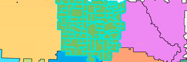
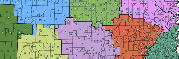
ポイント ソリューションのデフォルトのフィーチャクラスは、ベース テリトリーの中心です。
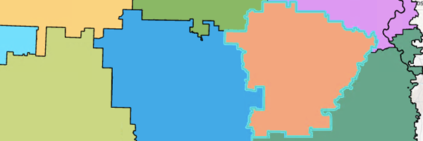
ポリゴン フィーチャクラスは、テリトリー レベルのフィーチャの境界線 (外周) を表します。
ポイント フィーチャクラスは、テリトリーの中心を表します。

パラメーター
|
ラベル
|
説明
|
データ タイプ
|
|
入力テリトリー ソリューション
|
解析で使用するテリトリー デザイン ソリューション レイヤー。
|
Group Layer; Feature Dataset; String
|
|
レベル
|
フィーチャクラスが追加されるレベル。
|
String
|
|
フィーチャクラス
|
指定した レベル パラメーター値で作成されるフィーチャクラスを指定します。
Territory Boundaries—Polygon features that represent the territory boundaries will be created.
Territory Centers—Point features that represent the territory centers will be created.
Base Boundaries—Polygon features that represent the base boundaries will be created.
Base Centers—Point features that represent the base centers will be created.
Line Barriers—Line features that restrict traversal across a line will be created.
Seed Points—Point features from which territories are derived will be created.
Restricted Areas—Polygon features that prevent the creation of territories will be created.
Polygon Barriers—Polygon features that restrict traversal across a polygon will be created.
|
String
|
派生した出力
|
ラベル
|
説明
|
データ タイプ
|
|
更新済みのテリトリー ソリューション
|
更新済みのテリトリー ソリューション。
|
Group Layer
|
arcpy.td.CreateTerritoryLevelFeatureClasses(in_territory_solution, level, feature_classes)
|
名前
|
説明
|
データ タイプ
|
|
in_territory_solution
|
解析で使用するテリトリー デザイン ソリューション レイヤー。
|
Group Layer; Feature Dataset; String
|
|
level
|
フィーチャクラスが追加されるレベル。
|
String
|
|
feature_classes
[feature_classes,...]
|
指定した level パラメーター値で作成されるフィーチャクラスを指定します。
TERRITORY_BOUNDARIES—Polygon features that represent the territory boundaries will be created.
TERRITORY_CENTERS—Point features that represent the territory centers will be created.
BASE_BOUNDARIES—Polygon features that represent the base boundaries will be created.
BASE_CENTERS—Point features that represent the base centers will be created.
LINE_BARRIERS—Line features that restrict traversal across a line will be created.
SEED_POINTS—Point features from which territories are derived will be created.
RESTRICTED_AREAS—Polygon features that prevent the creation of territories will be created.
POLYGON_BARRIERS—Polygon features that restrict traversal across a polygon will be created.
|
String
|
派生した出力
|
名前
|
説明
|
データ タイプ
|
|
out_territory_solution
|
更新済みのテリトリー ソリューション。
|
Group Layer
|
コードのサンプル
CreateTerritoryLevelFeatureClasses の例 (Python ウィンドウ)
次の Python ウィンドウ スクリプトは、CreateTerritoryLevelFeatureClasses 関数の使用方法を示しています。
import arcpy
arcpy.td.CreateTerritoryLevelFeatureClasses("TerritoryDesignSolution", "Territories[1]", "TERRITORY_BOUNDARIES;TERRITORY_CENTERS")
環境
現在のワークスペース
ライセンス情報
- Basic: Business Analyst が必要
- Standard: Business Analyst が必要
- Advanced: Business Analyst が必要