Create Territory Level Feature Classes (Territory Design Tools)
Краткая информация
Creates feature classes for a specified territory level.
Использование
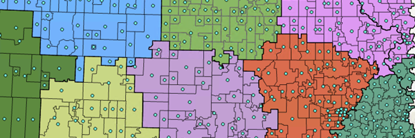
The output point feature classes represent the centers of the features at the base or territory level.
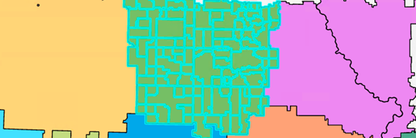
The output polygon feature classes represent the boundaries (perimeters) of the features at the base or territory level.
The base level can only contain base boundaries and base centers.
A Thiessen polygon will be created for the base boundary feature class if a point-based solution is created.
The default feature class for a polygon solution is Base Territory Boundaries.
The default feature class for a point solution is Base Territory Centers.
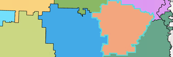
The polygon feature classes represent boundaries (perimeters) of the features in territory level.
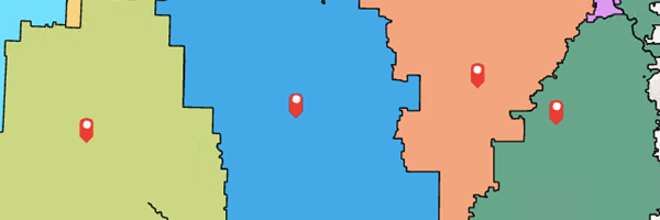
The point feature classes represent territory centers.
Параметры
|
Подпись
|
Объяснение
|
Тип данных
|
|
Input Territory Solution
|
The Territory Design solution layer that will be used in the analysis.
|
Group Layer; Feature Dataset; String
|
|
Level
|
The level to which the feature classes will be added.
|
String
|
|
Feature Classes
|
Specifies the feature classes that will be created at the specified Level parameter value.
Territory Boundaries–Polygon features that represent the territory boundaries will be created.
Territory Centers–Point features that represent the territory centers will be created.
Base Boundaries–Polygon features that represent the base boundaries will be created.
Base Centers–Point features that represent the base centers will be created.
Line Barriers–Line features that restrict traversal across a line will be created.
Seed Points–Point features from which territories are derived will be created.
Restricted Areas–Polygon features that prevent the creation of territories will be created.
Polygon Barriers–Polygon features that restrict traversal across a polygon will be created.
|
String
|
Производные выходные данные
|
Подпись
|
Объяснение
|
Тип данных
|
|
Updated Territory Solution
|
The updated territory solution.
|
Group Layer
|
arcpy.td.CreateTerritoryLevelFeatureClasses(in_territory_solution, level, feature_classes)
|
Имя
|
Объяснение
|
Тип данных
|
|
in_territory_solution
|
The Territory Design solution layer that will be used in the analysis.
|
Group Layer; Feature Dataset; String
|
|
level
|
The level to which the feature classes will be added.
|
String
|
|
feature_classes
[feature_classes,...]
|
Specifies the feature classes that will be created at the specified level parameter value.
TERRITORY_BOUNDARIES–Polygon features that represent the territory boundaries will be created.
TERRITORY_CENTERS–Point features that represent the territory centers will be created.
BASE_BOUNDARIES–Polygon features that represent the base boundaries will be created.
BASE_CENTERS–Point features that represent the base centers will be created.
LINE_BARRIERS–Line features that restrict traversal across a line will be created.
SEED_POINTS–Point features from which territories are derived will be created.
RESTRICTED_AREAS–Polygon features that prevent the creation of territories will be created.
POLYGON_BARRIERS–Polygon features that restrict traversal across a polygon will be created.
|
String
|
Производные выходные данные
|
Имя
|
Объяснение
|
Тип данных
|
|
out_territory_solution
|
The updated territory solution.
|
Group Layer
|
Пример кода
CreateTerritoryLevelFeatureClasses example (Python window)
The following Python window script demonstrates how to use the CreateTerritoryLevelFeatureClasses function.
import arcpy
arcpy.td.CreateTerritoryLevelFeatureClasses("TerritoryDesignSolution", "Territories[1]", "TERRITORY_BOUNDARIES;TERRITORY_CENTERS")
Параметры среды
Current Workspace
Информация о лицензировании
- Basic: Requires Business Analyst
- Standard: Requires Business Analyst
- Advanced: Requires Business Analyst