Generate Standard Geography Trade Areas (Business Analyst Tools)
汇总
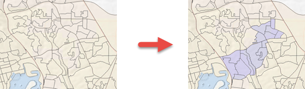
Creates trade areas based on predefined named statistical areas. This tool does not consume credits.
插图
用法
Standard geographies are trade areas based on standardized administrative boundaries. In the United States, this includes layers such as states, counties, ZIP Codes, block groups, census tracts, core-based statistical areas (CBSA), designated market areas (DMA), and places. Each country dataset offers administrative boundaries that can vary. Individual trade areas are created for each unique geography, for example, each state or each ZIP Code that you select.
When the Input Type parameter is set to List, the maximum number of features generated is 1000.
There is no maximum features limitation when the Input Type parameter is set to Table.
The table can be in any format supported by ArcGIS Pro, for example, a comma- or tab-delimited text file (
.txt) or a Microsoft Excel file.One layer can contain several trade areas, for example, one whole layer containing a collection of counties.
The list of IDs must be in a table or list format.
In the list format, the ID items must be separated by commas.
The geography ID for the entire country trade area is 01.
When the Input Type parameter is set to Table, the associated Geography Key Field parameter value must be a text field.
参数
| 标注 | 说明 | 数据类型 |
|---|---|---|
|
Geography Level |
The geography level that will be used to define the trade area. |
String |
|
Output Feature Class |
The output feature containing the trade area. |
Feature Class |
|
Input Type (可选) |
Specifies whether the geography IDs will be from a table or a list.
|
String |
|
Geography IDs Table (可选) |
The input table with IDs that will be used to select geographies that will define the trade area. |
Table View |
|
Geography Key Field (可选) |
A field in the Geography IDs Table parameter value that identifies the records that will be included in the output. |
Field |
|
Geography IDs List (可选) |
The input list of comma-separated geography IDs. |
String |
|
Summarize Duplicate IDs (可选) |
Specifies whether duplicate fields in the table containing matching geography IDs will be summarized.
|
Boolean |
|
Group Field (可选) |
The field that will be used to perform a group by operation. |
Field |
|
Dissolve Output Features (可选) |
Specifies whether the output will be dissolved based on the Group Field parameter value.
|
Boolean |
环境
Current Workspace, Data Source
许可信息
- 基本: Requires Business Analyst
- 标准: Requires Business Analyst
- 高级: Requires Business Analyst