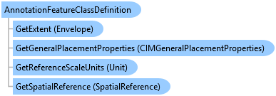
AnnotationFeatureClassDefinition Class
In This Topic
Represents the schema and properties of an AnnotationFeatureClass.
Object Model
Syntax
Public NotInheritable Class AnnotationFeatureClassDefinition
   Inherits ArcGIS.Core.Data.FeatureClassDefinition
   Implements System.IDisposable
public sealed class AnnotationFeatureClassDefinition : ArcGIS.Core.Data.FeatureClassDefinition, System.IDisposable
Example
Create Annotation Template
// Creates a new annotation template for the specified annotation layer.
await QueuedTask.Run(() =>
  {
    Inspector insp = null;
    // get the anno feature class
    var fc = annotationLayer.GetFeatureClass() as ArcGIS.Core.Data.Mapping.AnnotationFeatureClass;

    // get the feature class CIM definition which contains the labels, symbols
    var cimDefinition = fc.GetDefinition() as ArcGIS.Core.Data.Mapping.AnnotationFeatureClassDefinition;
    var labels = cimDefinition.GetLabelClassCollection();
    var symbols = cimDefinition.GetSymbolCollection();

    // make sure there are labels, symbols
    if (labels.Count == 0 || symbols.Count == 0)
      return;

    // find the label class required
    //   typically you would use a subtype name or some other characteristic
    // in this case lets just use the first one

    var label = labels[0];

    // each label has a textSymbol
    // the symbolName *should* be the symbolID to be used
    var symbolName = label.TextSymbol.SymbolName;
    int symbolID = -1;
    if (!int.TryParse(symbolName, out symbolID))
    {
      // int.TryParse fails - attempt to find the symbolName in the symbol collection
      foreach (var symbol in symbols)
      {
        if (symbol.Name == symbolName)
        {
          symbolID = symbol.ID;
          break;
        }
      }
    }
    // no symbol?
    if (symbolID == -1)
      return;

    // load the schema
    insp = new Inspector();
    insp.LoadSchema(annotationLayer);

    // ok to assign these fields using the inspector[fieldName] methodology
    //   these fields are guaranteed to exist in the annotation schema
    insp["AnnotationClassID"] = label.ID;
    insp["SymbolID"] = symbolID;

    // set up some additional annotation properties
    AnnotationProperties annoProperties = insp.GetAnnotationProperties();
    annoProperties.FontSize = 36;
    annoProperties.TextString = "My Annotation feature";
    annoProperties.VerticalAlignment = VerticalAlignment.Top;
    annoProperties.HorizontalAlignment = HorizontalAlignment.Justify;

    insp.SetAnnotationProperties(annoProperties);

    var tags = new[] { "Annotation", "tag1", "tag2" };

    // use daml-id rather than guid
    string defaultTool = "esri_editing_SketchStraightAnnoTool";

    // tool filter is the tools to filter OUT
    var toolFilter = new[] { "esri_editing_SketchCurvedAnnoTool" };

    // create a new template
    var newTemplate = annotationLayer.CreateTemplate("new annotation template", "description", insp, defaultTool, tags, toolFilter);
  });
Creating a new Annotation Feature in an Annotation FeatureClass using a RowBuffer
{
  // Must be called within QueuedTask.Run
  void CreatingAnAnnotationFeature(Geodatabase geodatabase)
  {
    using (AnnotationFeatureClass annotationFeatureClass = geodatabase.OpenDataset<AnnotationFeatureClass>("Annotation // feature // class // name"))
    using (AnnotationFeatureClassDefinition annotationFeatureClassDefinition = annotationFeatureClass.GetDefinition())
    using (RowBuffer rowBuffer = annotationFeatureClass.CreateRowBuffer())
    using (AnnotationFeature annotationFeature = annotationFeatureClass.CreateRow(rowBuffer))
    {
      annotationFeature.SetAnnotationClassID(0);
      annotationFeature.SetStatus(AnnotationStatus.Placed);

      // Get the annotation labels from the label collection
      IReadOnlyList<CIMLabelClass> labelClasses =
        annotationFeatureClassDefinition.GetLabelClassCollection();

      // Setup the symbol reference with the symbol id and the text symbol
      CIMSymbolReference cimSymbolReference = new CIMSymbolReference();
      cimSymbolReference.Symbol = labelClasses[0].TextSymbol.Symbol;
      cimSymbolReference.SymbolName = labelClasses[0].TextSymbol.SymbolName;

      // Setup the text graphic
      CIMTextGraphic cimTextGraphic = new CIMTextGraphic();
      cimTextGraphic.Text = "Charlotte, North Carolina";
      cimTextGraphic.Shape = new MapPointBuilderEx(new Coordinate2D(-80.843, 35.234), SpatialReferences.WGS84)
        .ToGeometry();
      cimTextGraphic.Symbol = cimSymbolReference;

      // Set the symbol reference on the graphic and store
      annotationFeature.SetGraphic(cimTextGraphic);
      annotationFeature.Store();
    }
  }
}
Creating an annotation feature class inside feature dataset
{
  // Must be called within QueuedTask.Run
  void CreateAnnotationFeatureClassUsingExistingAnnotationFeatureClassInDataset(
    Geodatabase geodatabase)
  {
    // Create a Cities annotation feature class inside Places feature dataset using existing annotation feature class

    // Feature dataset name
    string featureDatasetName = "Places";

    // Annotation feature class name
    string annotationFeatureClassName = "CitiesAnnotation";

    // Create a SchemaBuilder object
    SchemaBuilder schemaBuilder = new SchemaBuilder(geodatabase);

    // Open existing annotation feature class name
    using (AnnotationFeatureClass existingAnnotationFeatureClass = geodatabase.OpenDataset<AnnotationFeatureClass>("ExistingAnnotationFeatureClass"))
    {
      // Create Feature dataset description
      FeatureDatasetDescription featureDatasetDescription = new FeatureDatasetDescription(featureDatasetName, existingAnnotationFeatureClass.GetDefinition().GetSpatialReference());

      // Add the creation of the Places dataset to DDL task
      FeatureDatasetToken featureDatasetToken = schemaBuilder.Create(featureDatasetDescription);

      // Create an annotation feature class description using existing annotation feature class
      AnnotationFeatureClassDescription annotationFeatureClassDescription = new AnnotationFeatureClassDescription(annotationFeatureClassName,
          existingAnnotationFeatureClass.GetDefinition())
      {
        IsAutoCreate = true,
        IsSymbolIDRequired = false,
        IsUpdatedOnShapeChange = true
      };

      // Add the creation of the Cities annotation feature class inside Places feature dataset
      schemaBuilder.Create(new FeatureDatasetDescription(featureDatasetToken),
        annotationFeatureClassDescription);

      // Execute the DDL
      bool success = schemaBuilder.Build();

      // Inspect error messages
      if (!success)
      {
        IReadOnlyList<string> errorMessages = schemaBuilder.ErrorMessages;
        //etc.
      }
    }
  }
}
Inheritance Hierarchy
System.Object
ArcGIS.Core.CoreObjectsBase
ArcGIS.Core.Data.Definition
ArcGIS.Core.Data.TableDefinition
ArcGIS.Core.Data.FeatureClassDefinition
ArcGIS.Core.Data.Mapping.AnnotationFeatureClassDefinition
Requirements
Target Platforms: Windows 11 Home, Pro, Enterprise (64 bit)
ArcGIS Pro version: 3.0 or higher.
See Also