CIMLabelClass Class
In This Topic
Represents a label class which describes how to generate a set of text labels from a group of features in a feature layer.
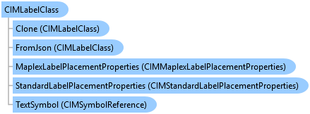
Object Model
Syntax
Public Class CIMLabelClass
   Inherits CIMObject
   Implements System.ComponentModel.INotifyPropertyChanged, System.Xml.Serialization.IXmlSerializable
public class CIMLabelClass : CIMObject, System.ComponentModel.INotifyPropertyChanged, System.Xml.Serialization.IXmlSerializable
Example
Evaluating an Arcade Labeling Expression
{
  string ArcadeLabelingExpressionName = "My Arcade Label Expression";

  //Consult https://github.com/Esri/arcade-expressions/ and
  //https://developers.arcgis.com/arcade/ for more examples
  //and arcade reference

  // Note: the following should be embedded in a QueuedTask.Run() statement
  {
    //Given a layer that has an arcade labeling
    //expression and we evaluate it interactively...
    var def = featureLayer.GetDefinition() as CIMFeatureLayer;
    //Get the label class
    var label_class = def.LabelClasses
                       .FirstOrDefault(lc =>
                       {
                         return lc.Name == ArcadeLabelingExpressionName &&
                                lc.ExpressionEngine == LabelExpressionEngine.Arcade;
                       });
    if (label_class == null)
      return;

    //evaluate the label expression against the features
    var expr_info = new CIMExpressionInfo()
    {
      Expression = label_class.Expression,
      ReturnType = ExpressionReturnType.String
    };

    //https://developers.arcgis.com/arcade/profiles/labeling/
    using var arcade = ArcadeScriptEngine.Instance.CreateEvaluator(
                                              expr_info, ArcadeProfile.Labeling);
    //loop through the features
    using var rc = featureLayer.Search();
    while (rc.MoveNext())
    {
      var variables = new List<KeyValuePair<string, object>>() {
          new("$feature", rc.Current)
        };
      var result = arcade.Evaluate(variables).GetResult();
      //output
      System.Diagnostics.Debug.WriteLine(
         $"[{rc.Current.GetObjectID()}]: {result}");
    }
  }
}
Modify label expression using Arcade
{
  // Note: the following should be embedded in a QueuedTask.Run() statement
  {
    //Get the layer's definition, using the community sample Data\Admin\AdminSample.aprx
    if (featureLayer.GetDefinition() is not CIMFeatureLayer lyrDefn)
    {
      // not a feature layer, leave
      return;
    }
    //Get the label classes - we need the first one
    var listLabelClasses = lyrDefn.LabelClasses.ToList();
    var theLabelClass = listLabelClasses.FirstOrDefault();
    //set the label class Expression to use the Arcade expression
    theLabelClass.Expression = "return $feature.STATE_NAME + TextFormatting.NewLine + $feature.POP2000;";
    //Set the label definition back to the layer.
    featureLayer.SetDefinition(lyrDefn);
  }
}
Creating a new Annotation Feature in an Annotation FeatureClass using a RowBuffer
{
  // Must be called within QueuedTask.Run
  void CreatingAnAnnotationFeature(Geodatabase geodatabase)
  {
    using (AnnotationFeatureClass annotationFeatureClass = geodatabase.OpenDataset<AnnotationFeatureClass>("Annotation // feature // class // name"))
    using (AnnotationFeatureClassDefinition annotationFeatureClassDefinition = annotationFeatureClass.GetDefinition())
    using (RowBuffer rowBuffer = annotationFeatureClass.CreateRowBuffer())
    using (AnnotationFeature annotationFeature = annotationFeatureClass.CreateRow(rowBuffer))
    {
      annotationFeature.SetAnnotationClassID(0);
      annotationFeature.SetStatus(AnnotationStatus.Placed);

      // Get the annotation labels from the label collection
      IReadOnlyList<CIMLabelClass> labelClasses =
        annotationFeatureClassDefinition.GetLabelClassCollection();

      // Setup the symbol reference with the symbol id and the text symbol
      CIMSymbolReference cimSymbolReference = new CIMSymbolReference();
      cimSymbolReference.Symbol = labelClasses[0].TextSymbol.Symbol;
      cimSymbolReference.SymbolName = labelClasses[0].TextSymbol.SymbolName;

      // Setup the text graphic
      CIMTextGraphic cimTextGraphic = new CIMTextGraphic();
      cimTextGraphic.Text = "Charlotte, North Carolina";
      cimTextGraphic.Shape = new MapPointBuilderEx(new Coordinate2D(-80.843, 35.234), SpatialReferences.WGS84)
        .ToGeometry();
      cimTextGraphic.Symbol = cimSymbolReference;

      // Set the symbol reference on the graphic and store
      annotationFeature.SetGraphic(cimTextGraphic);
      annotationFeature.Store();
    }
  }
}
Creating an annotation feature class
{
  // Must be called within QueuedTask.Run
  void CreateStandAloneAnnotationFeatureClass(
    Geodatabase geodatabase, SpatialReference spatialReference)
  {
    // Creating a Cities annotation feature class
    // with following user defined fields
    // Name
    // GlobalID

    // Annotation feature class name
    string annotationFeatureClassName = "CitiesAnnotation";

    // Create user defined attribute fields for annotation feature class
    FieldDescription globalIDFieldDescription = FieldDescription.CreateGlobalIDField();
    FieldDescription nameFieldDescription = FieldDescription.CreateStringField("Name", 255);

    // Create a list of all field descriptions
    List<FieldDescription> fieldDescriptions = new List<FieldDescription>
        { globalIDFieldDescription, nameFieldDescription };

    // Create a ShapeDescription object
    ShapeDescription shapeDescription = new ShapeDescription(GeometryType.Polygon, spatialReference);

    // Create general placement properties for Maplex engine
    CIMMaplexGeneralPlacementProperties generalPlacementProperties =
      new CIMMaplexGeneralPlacementProperties
      {
        AllowBorderOverlap = true,
        PlacementQuality = MaplexQualityType.High,
        DrawUnplacedLabels = true,
        InvertedLabelTolerance = 1.0,
        RotateLabelWithDisplay = true,
        UnplacedLabelColor = new CIMRGBColor
        {
          R = 0,
          G = 255,
          B = 0,
          Alpha = 0.5f // Green
        }
      };

    // Create general placement properties for Standard engine

    //CIMStandardGeneralPlacementProperties generalPlacementProperties =
    //  new CIMStandardGeneralPlacementProperties
    //  {
    //    DrawUnplacedLabels = true,
    //    InvertedLabelTolerance = 3.0,
    //    RotateLabelWithDisplay = true,
    //    UnplacedLabelColor = new CIMRGBColor
    //    {
    //      R = 255, G = 0, B = 0, Alpha = 0.5f // Red
    //    }
    //   };


    // Create annotation  label classes
    // Green label
    CIMLabelClass greenLabelClass = new CIMLabelClass
    {
      Name = "Green",
      ExpressionTitle = "Expression-Green",
      ExpressionEngine = LabelExpressionEngine.Arcade,
      Expression = "$feature.OBJECTID",
      ID = 1,
      Priority = 0,
      Visibility = true,
      TextSymbol = new CIMSymbolReference
      {
        Symbol = new CIMTextSymbol()
        {
          Angle = 45,
          FontType = FontType.Type1,
          FontFamilyName = "Tahoma",
          FontEffects = FontEffects.Normal,
          HaloSize = 2.0,

          Symbol = new CIMPolygonSymbol
          {
            SymbolLayers = new CIMSymbolLayer[]
            {
                new CIMSolidFill
                {
                  Color = CIMColor.CreateRGBColor(0, 255, 0)
                }
            },
            UseRealWorldSymbolSizes = true
          }
        },
        MaxScale = 0,
        MinScale = 0,
        SymbolName = "TextSymbol-Green"
      },
      StandardLabelPlacementProperties = new CIMStandardLabelPlacementProperties
      {
        AllowOverlappingLabels = true,
        LineOffset = 1.0
      },
      MaplexLabelPlacementProperties = new CIMMaplexLabelPlacementProperties
      {
        AlignLabelToLineDirection = true,
        AvoidPolygonHoles = true
      }
    };

    // Blue label
    CIMLabelClass blueLabelClass = new CIMLabelClass
    {
      Name = "Blue",
      ExpressionTitle = "Expression-Blue",
      ExpressionEngine = LabelExpressionEngine.Arcade,
      Expression = "$feature.OBJECTID",
      ID = 2,
      Priority = 0,
      Visibility = true,
      TextSymbol = new CIMSymbolReference
      {
        Symbol = new CIMTextSymbol()
        {
          Angle = 45,
          FontType = FontType.Type1,
          FontFamilyName = "Consolas",
          FontEffects = FontEffects.Normal,
          HaloSize = 2.0,

          Symbol = new CIMPolygonSymbol
          {
            SymbolLayers = new CIMSymbolLayer[]
            {
                new CIMSolidFill
                {
                  Color = CIMColor.CreateRGBColor(0, 0, 255)
                }
            },
            UseRealWorldSymbolSizes = true
          }
        },
        MaxScale = 0,
        MinScale = 0,
        SymbolName = "TextSymbol-Blue"
      },
      StandardLabelPlacementProperties = new CIMStandardLabelPlacementProperties
      {
        AllowOverlappingLabels = true,
        LineOffset = 1.0
      },
      MaplexLabelPlacementProperties = new CIMMaplexLabelPlacementProperties
      {
        AlignLabelToLineDirection = true,
        AvoidPolygonHoles = true
      }
    };

    // Create a list of labels
    List<CIMLabelClass> labelClasses = new List<CIMLabelClass> { greenLabelClass, blueLabelClass };

    // Create an annotation feature class description object to describe the feature class to create
    AnnotationFeatureClassDescription annotationFeatureClassDescription =
      new AnnotationFeatureClassDescription(annotationFeatureClassName, fieldDescriptions, shapeDescription,
        generalPlacementProperties, labelClasses)
      {
        IsAutoCreate = true,
        IsSymbolIDRequired = false,
        IsUpdatedOnShapeChange = true
      };

    // Create a SchemaBuilder object
    SchemaBuilder schemaBuilder = new SchemaBuilder(geodatabase);

    // Add the creation of the Cities annotation feature class to the list of DDL tasks
    schemaBuilder.Create(annotationFeatureClassDescription);

    // Execute the DDL
    bool success = schemaBuilder.Build();

    // Inspect error messages
    if (!success)
    {
      IReadOnlyList<string> errorMessages = schemaBuilder.ErrorMessages;
      //etc.
    }
  }
}
Creating a feature-linked annotation feature class
{
  // Must be called within QueuedTask.Run
  void CreateFeatureLinkedAnnotationFeatureClass(Geodatabase geodatabase,
    SpatialReference spatialReference)
  {
    // Creating a feature-linked annotation feature class between water pipe and valve in water distribution network
    // with following user defined fields
    // PipeName
    // GlobalID

    // Annotation feature class name
    string annotationFeatureClassName = "WaterPipeAnnotation";

    // Create user defined attribute fields for annotation feature class
    FieldDescription pipeGlobalID = FieldDescription.CreateGlobalIDField();
    FieldDescription nameFieldDescription = FieldDescription.CreateStringField("Name", 255);

    // Create a list of all field descriptions
    List<FieldDescription> fieldDescriptions = new List<FieldDescription>
        { pipeGlobalID, nameFieldDescription };

    // Create a ShapeDescription object
    ShapeDescription shapeDescription = new ShapeDescription(GeometryType.Polygon, spatialReference);

    // Create general placement properties for Maplex engine
    CIMMaplexGeneralPlacementProperties generalPlacementProperties = new CIMMaplexGeneralPlacementProperties
    {
      AllowBorderOverlap = true,
      PlacementQuality = MaplexQualityType.High,
      DrawUnplacedLabels = true,
      InvertedLabelTolerance = 1.0,
      RotateLabelWithDisplay = true,
      UnplacedLabelColor = new CIMRGBColor
      {
        R = 255,
        G = 0,
        B = 0,
        Alpha = 0.5f
      }
    };

    // Create annotation  label classes
    // Green label
    CIMLabelClass greenLabelClass = new CIMLabelClass
    {
      Name = "Green",
      ExpressionTitle = "Expression-Green",
      ExpressionEngine = LabelExpressionEngine.Arcade,
      Expression = "$feature.OBJECTID",
      ID = 1,
      Priority = 0,
      Visibility = true,
      TextSymbol = new CIMSymbolReference
      {
        Symbol = new CIMTextSymbol()
        {
          Angle = 45,
          FontType = FontType.Type1,
          FontFamilyName = "Tahoma",
          FontEffects = FontEffects.Normal,
          HaloSize = 2.0,

          Symbol = new CIMPolygonSymbol
          {
            SymbolLayers = new CIMSymbolLayer[]
            {
                new CIMSolidFill
                {
                  Color = CIMColor.CreateRGBColor(0, 255, 0)
                }
            },
            UseRealWorldSymbolSizes = true
          }
        },
        MaxScale = 0,
        MinScale = 0,
        SymbolName = "TextSymbol-Green"
      },
      StandardLabelPlacementProperties = new CIMStandardLabelPlacementProperties
      {
        AllowOverlappingLabels = true,
        LineOffset = 1.0
      },
      MaplexLabelPlacementProperties = new CIMMaplexLabelPlacementProperties
      {
        AlignLabelToLineDirection = true,
        AvoidPolygonHoles = true
      }
    };

    // Blue label
    CIMLabelClass blueLabelClass = new CIMLabelClass
    {
      Name = "Blue",
      ExpressionTitle = "Expression-Blue",
      ExpressionEngine = LabelExpressionEngine.Arcade,
      Expression = "$feature.OBJECTID",
      ID = 2,
      Priority = 0,
      Visibility = true,
      TextSymbol = new CIMSymbolReference
      {
        Symbol = new CIMTextSymbol()
        {
          Angle = 45,
          FontType = FontType.Type1,
          FontFamilyName = "Consolas",
          FontEffects = FontEffects.Normal,
          HaloSize = 2.0,

          Symbol = new CIMPolygonSymbol
          {
            SymbolLayers = new CIMSymbolLayer[]
            {
                new CIMSolidFill
                {
                  Color = CIMColor.CreateRGBColor(0, 0, 255)
                }
            },
            UseRealWorldSymbolSizes = true
          }
        },
        MaxScale = 0,
        MinScale = 0,
        SymbolName = "TextSymbol-Blue"
      },
      StandardLabelPlacementProperties = new CIMStandardLabelPlacementProperties
      {
        AllowOverlappingLabels = true,
        LineOffset = 1.0
      },
      MaplexLabelPlacementProperties = new CIMMaplexLabelPlacementProperties
      {
        AlignLabelToLineDirection = true,
        AvoidPolygonHoles = true
      }
    };

    // Create a list of labels
    List<CIMLabelClass> labelClasses = new List<CIMLabelClass> { greenLabelClass, blueLabelClass };


    // Create linked feature description
    // Linked feature class name
    string linkedFeatureClassName = "WaterPipe";

    // Create fields for water pipe
    FieldDescription waterPipeGlobalID = FieldDescription.CreateGlobalIDField();
    FieldDescription pipeName = FieldDescription.CreateStringField("PipeName", 255);

    // Create a list of water pipe field descriptions
    List<FieldDescription> pipeFieldDescriptions = new List<FieldDescription> { waterPipeGlobalID, pipeName };

    // Create a linked feature class description
    FeatureClassDescription linkedFeatureClassDescription = new FeatureClassDescription(linkedFeatureClassName,
      pipeFieldDescriptions,
      new ShapeDescription(GeometryType.Polyline, spatialReference));

    // Create a SchemaBuilder object
    SchemaBuilder schemaBuilder = new SchemaBuilder(geodatabase);

    // Add the creation of the linked feature class to the list of DDL tasks
    FeatureClassToken linkedFeatureClassToken = schemaBuilder.Create(linkedFeatureClassDescription);

    // Create an annotation feature class description object to describe the feature class to create
    AnnotationFeatureClassDescription annotationFeatureClassDescription =
      new AnnotationFeatureClassDescription(annotationFeatureClassName, fieldDescriptions, shapeDescription,
        generalPlacementProperties, labelClasses, new FeatureClassDescription(linkedFeatureClassToken))
      {
        IsAutoCreate = true,
        IsSymbolIDRequired = false,
        IsUpdatedOnShapeChange = true
      };

    // Add the creation of the annotation feature class to the list of DDL tasks
    schemaBuilder.Create(annotationFeatureClassDescription);

    // Execute the DDL
    bool success = schemaBuilder.Build();

    // Inspect error messages
    if (!success)
    {
      IReadOnlyList<string> errorMessages = schemaBuilder.ErrorMessages;
      //etc.
    }
  }
}
Apply text symbol to a feature layer
{
  // Note: call within QueuedTask.Run()
  {
    //Get the layer's definition
    var lyrDefn = featureLayer.GetDefinition() as CIMFeatureLayer;
    //Get the label classes - we need the first one
    var listLabelClasses = lyrDefn.LabelClasses.ToList();
    var theLabelClass = listLabelClasses.FirstOrDefault();
    //Set the label classes' symbol to the custom text symbol
    //Refer to the ProSnippets-TextSymbols wiki page for help with creating custom text symbols.
    //Example: var textSymbol = await CreateTextSymbolWithHaloAsync();
    theLabelClass.TextSymbol.Symbol = textSymbol;
    lyrDefn.LabelClasses = listLabelClasses.ToArray(); //Set the labelClasses back
    featureLayer.SetDefinition(lyrDefn); //set the layer's definition
                                         //set the label's visibility
    featureLayer.SetLabelVisibility(true);
  }
}
Modify the Placement/Position of labels - Point geometry
{
  // Note: call within QueuedTask.Run()
  {
    //Get the layer's definition
    var lyrDefn = featureLayer.GetDefinition() as CIMFeatureLayer;
    //Get the label classes - we need the first one
    var listLabelClasses = lyrDefn.LabelClasses.ToList();
    var theLabelClass = listLabelClasses.FirstOrDefault();

    //Modify label Placement
    //Check if the label engine is Maplex or standard.
    CIMGeneralPlacementProperties labelEngine =
       MapView.Active.Map.GetDefinition().GeneralPlacementProperties;
    if (labelEngine is CIMStandardGeneralPlacementProperties) //Current labeling engine is Standard labeling engine
      theLabelClass.StandardLabelPlacementProperties.PointPlacementMethod =
               StandardPointPlacementMethod.OnTopPoint;
    else    //Current labeling engine is Maplex labeling engine
      theLabelClass.MaplexLabelPlacementProperties.PointPlacementMethod =
              MaplexPointPlacementMethod.CenteredOnPoint;

    lyrDefn.LabelClasses = listLabelClasses.ToArray(); //Set the labelClasses back
    featureLayer.SetDefinition(lyrDefn); //set the layer's definition
  }
}
How to apply a Text Symbol to label of a layer
{
  var cimMap = MapView.Active.Map.GetDefinition();

  CIMTextSymbol simpleTextSymbol = SymbolFactory.Instance.ConstructTextSymbol(ColorFactory.Instance.GreenRGB, 8.5, "Corbel", "Regular");
  var lyrDefn = theLayerToLabel.GetDefinition() as CIMFeatureLayer;
  //Get the label classes - we need the first one
  var listLabelClasses = lyrDefn.LabelClasses.ToList();
  var theLabelClass = listLabelClasses.FirstOrDefault();
  //Place all labels horizontally
  theLabelClass.StandardLabelPlacementProperties.LineLabelPosition.Horizontal = true;
  //theLabelClass.MaplexLabelPlacementProperties.AlignLabelToLineDirection = true;
  //Set the label classes' symbol to the custom text symbol
  theLabelClass.TextSymbol.Symbol = simpleTextSymbol;
  lyrDefn.LabelClasses = listLabelClasses.ToArray(); //Set the labelClasses back
  theLayerToLabel.SetDefinition(lyrDefn);
  (theLayerToLabel as FeatureLayer).SetLabelVisibility(true);
}
Inheritance Hierarchy
System.Object
ArcGIS.Core.CIM.CIMObject
ArcGIS.Core.CIM.CIMLabelClass
Requirements
Target Platforms: Windows 11 Home, Pro, Enterprise (64 bit)
ArcGIS Pro version: 3.0 or higher.
See Also