Select the mosaic dataset where you want to recompute the boundary.
Mosaic Layer
Query Definition
(Optional)
An SQL query to compute a boundary for select raster datasets. Use this option in conjunction with the Append to Existing Boundary option to save time when adding new raster datasets.
SQL Expression
Append To Existing Boundary
(Optional)
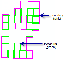
Specifies whether the perimeter of footprints will be appended to the existing boundary or the boundary will be recalculated in its entirety.
Check this parameter when adding new raster datasets to an existing mosaic dataset. Instead of calculating the entire boundary, only the boundary of the new raster datasets will merged with the existing boundary.
Checked—The perimeter of footprints will be appended to the existing boundary. This can save time when adding additional raster data to the mosaic dataset, as the entire boundary will not be recalculated. If there are rasters selected, the boundary will be recalculated to include only the selected footprints. This is the default.
Unchecked—The boundary will be recalculated in its entirety.
Boolean
Simplification Method
(Optional)
Specifies the simplification method that will be used to reduce the number of vertices, since a dense boundary can affect performance.
Choose the simplification method to use to simplify the boundary.
None—No simplification method will be used. This is the default.
Convex hull—The minimum bounding geometry of the mosaic dataset will be used to simplify the boundary. If there are disconnected footprints, a minimum bounding geometry for each continuous group of footprints will be used to simplify the boundary.
Envelope—The envelope of the mosaic dataset will provide a simplified boundary. If there are disconnected footprints, an envelope for each continuous group of footprints will be used to simplify the boundary.
Select the mosaic dataset where you want to recompute the boundary.
Mosaic Layer
where_clause
(Optional)
An SQL query to compute a boundary for select raster datasets. Use this option in conjunction with setting the append_to_existing parameter to APPEND to save time when adding new raster datasets.
SQL Expression
append_to_existing
(Optional)
Specifies whether the perimeter of footprints will be appended to the existing boundary or the boundary will be recalculated in its entirety.
Use the APPEND option when adding new raster datasets to an existing mosaic dataset. Instead of calculating the entire boundary, only the boundary of the new raster datasets will be merged with the existing boundary.
APPEND—The perimeter of footprints will be appended to the existing boundary. This can save time when adding additional raster data to the mosaic dataset, as the entire boundary will not be recalculated. If there are rasters selected, the boundary will be recalculated to include only the selected footprints. This is the default.
OVERWRITE—The boundary will be recalculated in its entirety.
Boolean
simplification_method
(Optional)
Specifies the simplification method that will be used to reduce the number of vertices, since a dense boundary can affect performance.
Choose the simplification method to use to simplify the boundary.
NONE—No simplification method will be used. This is the default.
CONVEX_HULL—The minimum bounding geometry of the mosaic dataset will be used to simplify the boundary. If there are disconnected footprints, a minimum bounding geometry for each continuous group of footprints will be used to simplify the boundary.
ENVELOPE—The envelope of the mosaic dataset will provide a simplified boundary. If there are disconnected footprints, an envelope for each continuous group of footprints will be used to simplify the boundary.
String
Derived output
Name
Explanation
Data type
out_mosaic_dataset
The updated mosaic dataset.
Mosaic Layer
Code sample
BuildBoundary example 1 (Python window)
This is a Python sample for the BuildBoundary tool.