What is an Observation Workbench?
Overview
Observation collection is the process of visually gathering and processing information from geospatial imagery to understand changes in the area of interest; or looking for specific features, objects, or other phenomena. Observations can be categorized as either object-based or activity-based. Object-based observations capture the physical aspects of what is observed, such as the type of object, measurements, and other physical characteristics. Activity-based observations are often descriptions of what is occurring at a location at a point in time. These two types of observations provide the detailed intelligence data needed to solve particular intelligence problems. For example, object-based observations can be used for Order of Battle analysis or port monitoring for economic analysis; activity-based observations may capture the time and number of people or things gathering at a particular location.
An Observation Workbench is an imagery-based working environment that is ready for observation collection. The workbench is a map view that contains many of the data elements needed to exploit imagery, including orthorectified image layers for collecting observations with a higher degree of geospatial accuracy. An Observation Workbench is created using Create Observation Workbench. Create Observation Workbench is a single tool that combines several individual tools and many steps to more efficiently create a ready-to-exploit observation environment.
Learn more about creating an Observation Workbench.
Components
Depending on your selection of data sources, an Observation Workbench can contain:
Individually orthorectified image layers
Unorthorectified image layers
New and existing feature layers
Elevation
Basemaps
Orthorectified Image Layers
Orthorectification is a process that removes distortions in imagery caused by the image sensor and terrain. The result is a consistent scale across all parts of the image. The process creates a new temporary image layer in the project that must be saved to persist outside the project.
Create Observation Workbench uses the raster Geometric Function to create individual orthorectified image layers from your image sources. The Constant Z parameter is not used. Multiple image inputs may be selected when creating a new workbench.
The Geometric Function requires an image with a sensor model definition. Rational Polynomial Coefficent (RPC) information is included in, or accompanies, most commercially distributed satellite imagery. The Geometric Function does not support aerial imagery with table-based camera models.
Note:
Create Observation Workbench does not support image services or mosaic dataset inputs.
Unorthorectified Image Layers
Image inputs without supported sensor model information or the overlapping elevation needed for orthorectification are added to the new workbench, but are uncorrected. This option allows you to display additional image sources for reference, or to use previously corrected images. You will receive a warning If any input images do not meet this criteria.
Observation Feature Layers
When creating a new workbench existing feature layers can be added as observation layers to collect features of interest from the imagery. If your project does not have any features you can create new point, line, polygon, and multi-point feature layers. Multiple feature layers may be selected or created with Create Observation Workbench at one time.
Note:
Two new text attribute fields, Label and Analyst Comment, are appended to existing feature classes and included in newly created feature classes. You must have write access to include existing feature data.

When adding new feature layers, geodatabase rules for naming conventions apply. Names must be unique, start with a letter and contain only alphanumeric characters and underscores. Spaces and special characters are not permitted. The new feature layer will display by this name in the workbench unless you provide an Alias. Aliases are more user-friendly and may contain spaces, special characters and start with numbers.
The new observation feature classes are saved to the current project geodatabase by default. You can change the location to point to another file geodatabase or enterprise geodatabase.
Editing Feature Layers
New and existing feature layers added to the workbench are ready to be edited to add observations. Learn about editing feature layers in a quick tour of editing.
Elevation
A raster elevation dataset or elevation service is required for orthorectification of imagery, but is otherwise optional, and displays as a raster layer in the new workbench. Only one elevation source may be selected for workbench creation. Create Observation Workbench checks your elevation extents against your image extents. A warning message appears for imagery that does not fully overlap the elevation dataset extent.
The importance of terrain correction
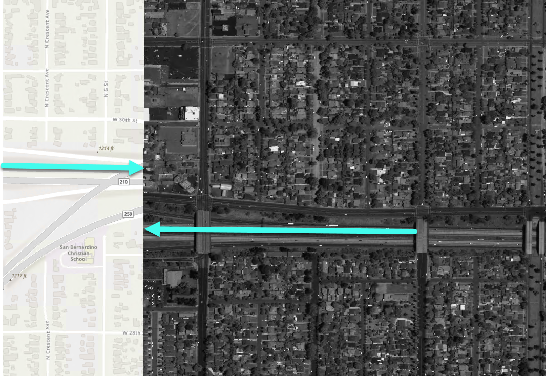
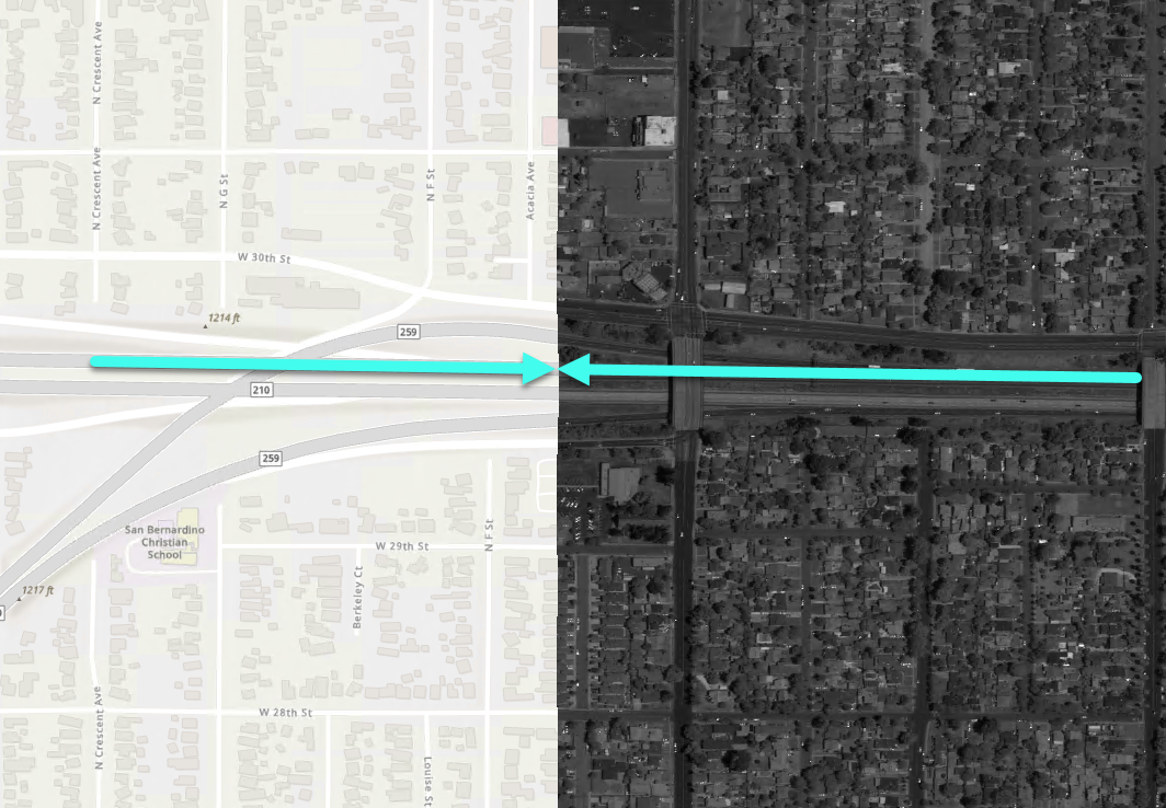
Including elevation data for image correction improves accuracy of collected observations. The example graphic below shows a portion of a satellite image acquired near Redlands, California.
The on the left the image is displayed as unorthorectified. Note the features on the basemap do not line up with the corresponding features in the image. On the right the same orthorectified image in the workbench lines up with the basemap. Both show the same image over the same basemap. The amount of correction necessary will vary by image and terrain, but this illustrates the role elevation data can play in capturing more geospatially accurate observations.
Basemaps
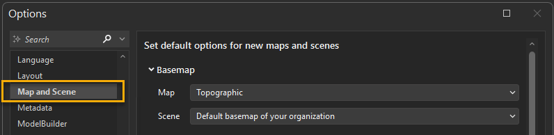
By default, a basemap is not included in a new workbench. When creating a workbench you have the option to add a basemap. The basemap added is specified in your AllSource application settings. You may view or change your basemap settings in the Map and Scene options.