Split multipart centerlines into singlepart features
 Available with the Linear Referencing license.
The Split Centerlines Into Singlepart Features tool is a centerline feature class editing tool available in ArcGIS Linear Referencing. This tool breaks multipart centerlines into singlepart features for use with complex routes.
This tool is typically used to separate multipart or gapped centerlines, to split self-intersecting centerlines at their junction points, or to break apart enclosed loops.
This tool can only be used with a centerline layer in a feature service. If the feature service is not yet published, see Share as web layers.
Tip:
ArcGIS Linear Referencing also supports splitting a centerline by point or splitting a centerline by measure.
To split multipart centerlines into singlepart features, complete the following steps:
Add the centerline feature class and network feature class to a map.
You can also open a map in which the centerline and network feature classes are already present.
Note:
In the LRS data model, only one centerline can exist at any given location. Ensure that the centerlines used for your edit do not overlap other centerlines in the LRS.
Branch versioned networks, including any network configured with a user-generated route ID, must be edited through a feature service.
Zoom to the centerlines that you want to split.
On the Linear Referencing tab, in the Centerline Editing group, click Split Centerline, and click Into Singlepart Features
 .
The Split Centerlines Into Singlepart Features pane appears.
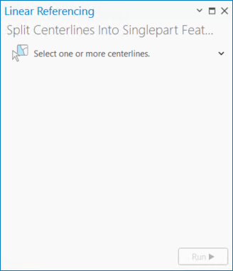
Click the Select one or more centerlines drop-down arrow and choose a selection method.
On the map, select one or more centerlines that you want to split.
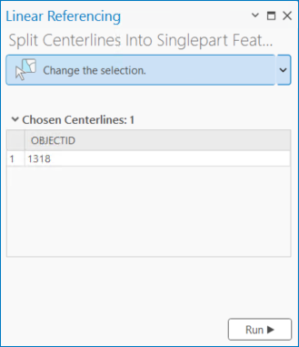
The selected centerlines are highlighted on the map, and the Chosen Centerlines section appears in the pane with the centerlines listed in order of selection.
Tip:
To change the display field in the Chosen Centerlines section, right-click the centerline layer in the Contents pane, and choose Properties from the context menu. On the Layer Properties dialog box, click the Display tab, and click the Display field drop-down arrow to change its value. In the example above, the display field is
OBJECTID.Click Run.
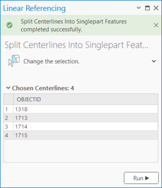
The selected multipart centerlines are split, and the newly separated centerlines flash in cyan on the map.
The Chosen Centerlines section lists each newly created singlepart centerline feature.
Note:
Attributes from centerlines that are split are added to the resulting singlepart centerline features.
If a message about acquiring locks appears, it means that conflict prevention is enabled.
Optionally, click a singlepart centerline feature in the Chosen Centerlines section to flash it on the map.