Add Rasters To Mosaic Dataset (Data Management Tools)
Summary
Adds raster datasets to a mosaic dataset from various sources, including a file, folder, table, or web service.
Usage
Raster data that is added is not managed; if the raster data is deleted or moved, the mosaic dataset will be affected.
You can only add rasters to a mosaic dataset contained in a geodatabase. Those created outside a geodatabase can only contain the contents of a previously created mosaic dataset.
The Raster Type parameter identifies metadata required for loading data into the mosaic dataset.
The raster type is specific to imagery products. It identifies metadata—such as georeferencing, acquisition date, and sensor type—along with a raster format.
The Raster Type Properties page contains information about the supported product types and processing templates based on the selected raster type. You can define various other properties such as Stretch, Gamma, Orthorectification, Band Combination, and Pansharpening types based on the analysis and the data being used.
The Processing Templates drop-down list includes functions that will be applied to items that will be added to the mosaic dataset and how, or in what order, they will be applied.
For faster display and processing, the pixel cache for a mosaic dataset can be generated when the Enable Pixel Cache parameter is checked.
Parameters
| Label | Explanation | Data type |
|---|---|---|
|
Mosaic Dataset |
The path and name of the mosaic dataset to which the raster data will be added. |
Mosaic Layer |
|
Raster Type |
The type of raster that will be added. The raster type is specific to imagery products. It identifies metadata—such as georeferencing, acquisition date, and sensor type—along with a raster format. If you are using a LAS, LAS Dataset, or Terrain raster type, a cell size must be specified on the Raster Type properties page. To learn more about supported sensors and raster types, see List of supported sensors. Use the Processing Templates drop-down list to choose, import, or create a raster function chain (template) to apply to the mosaic dataset or items. The function chains will be used to process a mosaic dataset or the mosaic dataset items on the fly. You can add, remove, or reorder the function chains. All the template names that are added must be unique. The Processing Templates drop-down list contains functions that will be applied to items that are added to the mosaic dataset and how, or in what order, they will be applied. You can use a single function, such as the Stretch function, or you can chain multiple functions together to create a more advanced product. Most raster types have several preexisting functions associated with them. Use this drop-down list to edit existing functions or add new functions to items that will be added to the mosaic dataset.
|
Raster Type |
|
Input Data |
Specifies the path and name of the input file, folder, raster dataset, mosaic dataset, table, or service. Not all input options will be available. The selected raster type determines the available options.
|
File; Image Service; LAS Dataset Layer; Layer File; Map Server; Mosaic Layer; Raster Layer; Table View; Terrain Layer; WCS Coverage; WMS Map; Workspace |
|
Update Cell Size Ranges (Optional) |
Specifies whether the cell size ranges of each raster in the mosaic dataset will be calculated. These values will be written to the attribute table in the
|
Boolean |
|
Update Boundary (Optional) |
Specifies whether the boundary polygon of a mosaic dataset will be generated or updated. By default, the boundary merges all the footprint polygons to create a single boundary representing the extent of the valid pixels.
|
Boolean |
|
Update Overviews (Optional) |
Specifies whether overviews for a mosaic dataset will be defined and generated.
|
Boolean |
|
Maximum Levels (Optional) |
The maximum number of pyramid levels that will be used in the mosaic dataset. For example, a value of 2 will use only the first two pyramid levels from the source raster. Leaving this parameter blank or providing a value of -1 will build pyramids for all levels. This value can affect the display and number of overviews that will be generated. |
Long |
|
Maximum Cell Size (Optional) |
The maximum pyramid cell size that will be used in the mosaic dataset. |
Double |
|
Minimum Rows or Columns (Optional) |
The minimum dimensions of a raster pyramid that will be used in the mosaic dataset. |
Long |
|
Coordinate System for Input Data (Optional) |
The spatial reference system of the input data. Specify a value if the data does not have a coordinate system; otherwise, the coordinate system of the mosaic dataset will be used. This can also be used to override the coordinate system of the input data. |
Spatial Reference |
|
Input Data Filter (Optional) |
A filter for the data being added to the mosaic dataset. You can use SQL expressions to create the data filter. The wildcards for the filter work on the full path to the input data. For example, the following SQL statement will select the rows in which the following object IDs match:
To add only a TIFF image, add an asterisk before a file extension.
To add an image with the word sensor in the file path or file name, add an asterisk before and after the word sensor.
You can also use PERL syntax to create a data filter.
The following PERL syntax with multiple lexical groupings as part of the expression is not supported:
Alternatively, you can use the following syntax:
|
String |
|
Include Sub Folders (Optional) |
Specifies whether subfolders will be recursively explored.
|
Boolean |
|
Add New Datasets Only (Optional) |
Specifies how duplicate rasters will be handled. A check will be performed to determine whether each raster has already been added, using the original path and file name. Specify the option to use when a duplicate path and file name are found.
|
String |
|
Build Raster Pyramids (Optional) |
Specifies whether pyramids will be built for each source raster.
|
Boolean |
|
Calculate Statistics (Optional) |
Specifies whether statistics will be calculated for each source raster. If a source raster has statistics, the statistics will not be recomputed if the skip factor matches with the settings in the Raster Statistics environment. Otherwise, the statistics for each source raster will be recomputed.
|
Boolean |
|
Build Thumbnails (Optional) |
Specifies whether thumbnails will be built for each source raster.
|
Boolean |
|
Operation Description (Optional) |
The description that will be used to represent the operation of adding raster data. It will be added to the raster type table, which can be used as part of a search or as a reference at another time. |
String |
|
Force this Coordinate System for Input Data (Optional) |
Specifies the coordinate system that will be used. Use the coordinate system specified in the Coordinate System for Input Data parameter for all the rasters when loading data into the mosaic dataset.
|
Boolean |
|
Estimate Mosaic Dataset Statistics (Optional) |
Specifies whether statistics will be estimated on the mosaic dataset for faster rendering and processing at the mosaic dataset level.
|
Boolean |
|
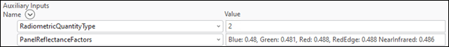
Auxiliary Inputs (Optional) |
The raster type settings that will be defined in the raster type. This parameter will override the settings defined in the raster type. Auxiliary input options include the following:
Value table columns:
|
Value Table |
|
Enable Pixel Cache (Optional) |
Specifies whether the pixel cache will be generated for faster display and processing of the mosaic dataset.
|
Boolean |
|
Pixel Cache Location (Optional) |
The location of the pixel cache. If no location is provided, the cache will be written to Once the location is provided, you do not need to redefine the path when adding new rasters to the mosaic dataset. You do need to check the Enable Pixel Cache parameter when adding the new data. |
Folder; String |
Derived output
| Label | Explanation | Data type |
|---|---|---|
|
Updated Mosaic Dataset |
The updated mosaic dataset. |
Mosaic Layer |
Environments
Current Workspace, Extent, Geographic Transformations, Parallel Processing Factor, Pyramid, Raster Statistics, Scratch Workspace
Licensing information
- Basic: No
- Standard: Yes
- Advanced: Yes