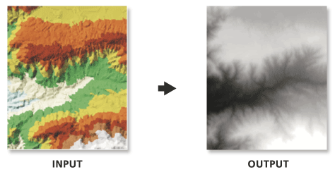
入力 TIN サーフェスの内挿は定期的に行われるため、出力ラスターでは一部の情報が損失することが予測されます。 ラスターがどれだけ正確に TIN を表現できるかは、ラスターの解像度や、TIN サーフェスの変化の度合いおよび間隔によって異なります。 一般に、解像度を上げると、出力ラスターは TIN サーフェスをより忠実に表現します。 ラスターはセル構造であるため、TIN に存在する可能性のあるハードおよびソフトなブレークラインのエッジを維持することはできません。
Floating Point—The output raster will use 32-bit floating point, which supports values ranging from -3.402823466e+38 to 3.402823466e+38. This is the default.
Integer—The output raster will use an appropriate integer bit depth. This option will round z-values to the nearest whole number and write an integer to each raster cell value.
String
方法
(オプション)
ラスターの作成に使用する内挿法。
Linear—Calculates cell values by applying linear interpolation to the TIN triangles. This is the default.
Natural Neighbors—Calculates cell values by using natural neighbors interpolation of TIN triangles
String
サンプリング距離
(オプション)
出力ラスターのセル サイズを定義するために使用するサンプリング方法と距離。
Observations—Defines the number of cells that divide the longest side of the output raster. This method is used by default with the value of 250.
Cell Size—Defines the cell size of the output raster.
String
Z 係数
(オプション)
Z 値に乗算する係数。 これは通常、Z 距離単位から X、Y 距離単位に変換する場合に使用されます。 デフォルトは 1 です。この場合、標高値は変更されません。 入力サーフェスの空間参照に距離単位の指定された Z 測地基準系がある場合、このパラメーターは使用できません。
FLOAT—The output raster will use 32-bit floating point, which supports values ranging from -3.402823466e+38 to 3.402823466e+38. This is the default.
INT—The output raster will use an appropriate integer bit depth. This option will round z-values to the nearest whole number and write an integer to each raster cell value.
String
method
(オプション)
ラスターの作成に使用する内挿法。
LINEAR—Calculates cell values by applying linear interpolation to the TIN triangles. This is the default.
NATURAL_NEIGHBORS—Calculates cell values by using natural neighbors interpolation of TIN triangles
String
sample_distance[sampling_method distance,...]
(オプション)
出力ラスターのセル サイズを定義するために使用するサンプリング方法と距離。
OBSERVATIONS—Defines the number of cells that divide the longest side of the output raster. This method is used by default with the value of 250.
CELLSIZE—Defines the cell size of the output raster.
String
z_factor
(オプション)
Z 値に乗算する係数。 これは通常、Z 距離単位から X、Y 距離単位に変換する場合に使用されます。 デフォルトは 1 です。この場合、標高値は変更されません。 入力サーフェスの空間参照に距離単位の指定された Z 測地基準系がある場合、このパラメーターは使用できません。
'''******************************************************************
Name: TinRaster Example
Description: This script demonstrates how to use the
             TinRaster tool to create rasters from
             each TIN in the target workspace.
******************************************************************'''
# Import system modules
import arcpy

# Set environment setting
arcpy.env.workspace = "C:/data"

# Set Local Variables
dataType = "INT"
method = "NATURAL_NEIGHBORS"
sampling = "CELLSIZE 10"
zfactor = "1"

# Create list of TINs
TINList = arcpy.ListDatasets("*", "Tin")

# Verify the presence of TINs in the list
if TINList:
    # Iterate through the list of TINs
    for dataset in TINList:
        # Define the name of the output file
        outRaster = "{0}_natural.img".format(dataset)
        # Run TinRaster
        arcpy.ddd.TinRaster(dataset, outRaster, dataType,
                            method, sampling, zfactor)
    print("Finished.")
else:
    print("There are no TIN(s) in {0}.".format(env.workspace))