Editar TIN (Herramientas de 3D Analyst)

Resumen

Carga datos de una o más entidades de entrada para modificar la superficie de una red irregular de triángulos (TIN) existente.

Más información sobre cómo funciona Editar TIN

Ilustración

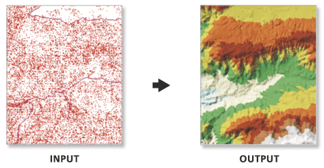
Ilustración de la herramienta Editar TIN

Las líneas de corte se añaden a la TIN.

Uso

  • Esta herramienta modifica la TIN de entrada. Plantéese usar la herramienta Copiar TIN para conservar una copia de seguridad si desea conservar una versión sin modificar de la TIN de origen.

  • El tipo de entidad de superficie define la manera en que las entidades de entrada influirán en la definición de la superficie triangulada.

    • Las entidades de punto se pueden especificar como puntos de masa, que proporcionan nodos de datos con valores z que se utilizan en la triangulación de la superficie.

    • Las entidades de línea pueden especificarse como puntos de masa y líneas de corte, que representan ubicaciones a lo largo de una superficie con discontinuidades lineales en la pendiente, como líneas de cresta, líneas de costa, bordes de pavimento, huellas de edificios, etc.

    • Las entidades de polígono también pueden especificarse como puntos de masa y líneas de corte, junto con entidades de recorte que definen el área de datos, entidades de reemplazo que definen regiones con valores z constantes (por ejemplo, masas de agua) y entidades de borrado que indican áreas interiores donde no existen datos.

  • La herramienta puede crear un TIN compuesto por muchos millones de puntos si dispone de memoria suficiente. Sin embargo, limitar el número de nodos TIN a menos de 6 millones garantizará el rendimiento de visualización y la usabilidad general. Si se necesita una superficie TIN más grande, considere la posibilidad de utilizar un dataset de terreno. El dataset de terreno ofrece una superficie TIN multirresolución que puede admitir colecciones mucho más grandes de mediciones de origen.

Parámetros

Etiqueta Explicación Tipo de datos

TIN de entrada

Dataset TIN que se procesará.

TIN Layer

Definición de entidad de superficie

Entidades de entrada y sus propiedades relacionadas que definen cómo se agregarán al TIN.

Columnas de la tabla de valores:

  • Input FeaturesThe features that will be added to the TIN.

  • Height FieldThe field from the input's attribute table that will provide the elevation for its features. The z- or m-values in the Shape field can be used along with any numeric field. Choosing the <None> option will result in the feature's elevation being interpolated from its surrounding 3D measurements.

  • Tag FieldA numeric attribute will be assigned to the TIN's data elements using values obtained from an integer field in the input feature's attribute table.

  • TypeThe input feature's role in defining the TIN surface. The available options depend on the geometry of the input features. For line- and polygon-based surface feature types, the hard and soft designations for the surface feature type impact the way the line or polygon boundary is handled when interpolating a raster surface from the TIN dataset when using natural neighbor interpolation. A hard surface feature type represents a border with a sharp discontinuity in elevation, such as the edge of a cliff, a wall, or a curb on the side of the road. A soft surface feature type represents a border where the elevation is more smoothly defined.

    • Mass PointsElevation measurements will be incorporated as TIN nodes.

    • Hard LineBreakline features will define linear discontinuities in the TIN.

    • Soft LineBreakline features will define linear discontinuities in the TIN.

    • Hard ClipPolygon features will define the data area of the TIN surface.

    • Soft ClipPolygon features will define the data area of the TIN surface.

    • Hard ErasePolygon features will define interior voids in the data.

    • Soft ErasePolygon features will define interior voids in the data.

    • Hard ReplacePolygon features will define areas of constant height.

    • Soft ReplacePolygon features will define areas of constant height.

    • Hard Value FillInteger attributes will be assigned to nodes and triangle faces.

    • Soft Value FillInteger attributes will be assigned to nodes and triangle faces.

  • Use ZSpecifies whether z- or m-values will be used when the SHAPE field is specified as the height source. Specifying True indicates that z-values will be used; specifying False indicates that m-values will be used.

Value Table

Restringida de Delaunay

(Opcional)

Especifica la técnica de triangulación que se va a utilizar a lo largo de las líneas de corte de TIN.

  • ActivadoThe TIN will use constrained Delaunay triangulation, which will add each segment as a single edge. Delaunay triangulation rules are honored everywhere except along breaklines, which will not be densified.

  • DesactivadoThe TIN will use Delaunay conforming triangulation, which may densify each segment of the breaklines to produce multiple triangle edges. This is the default.

Boolean

Salida derivada

Etiqueta Explicación Tipo de datos

TIN actualizado

El TIN actualizado.

TIN Layer

Entornos

Espacio de trabajo actual, Extensión

Información de licenciamiento

  • Basic: Requiere 3D Analyst
  • Standard: Requiere 3D Analyst
  • Avanzado: Requiere 3D Analyst