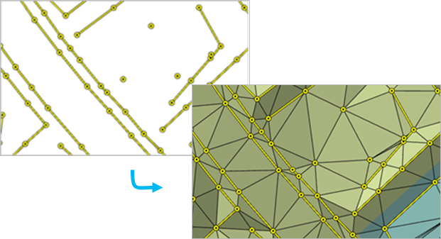
arcpy.3d.CreateTin(out_tin, {spatial_reference}, {in_features}, {constrained_delaunay})
|
名前
|
説明
|
データ タイプ
|
|
out_tin
|
生成される TIN データセット。
|
TIN
|
|
spatial_reference
(オプション)
|
出力 TIN の空間参照。 空間参照を投影座標系に設定します。 地理座標系はおすすめしません。x,y 座標が角度単位で表現される場合に、ドロネー三角形分割は保証できないため、傾斜角、体積、見通し線などの距離ベースの計算の精度に悪影響を及ぼす可能性があるためです。
|
Coordinate System
|
|
in_features
[[in_features, height_field, SF_type, tag_value],...]
(オプション)
|
TIN への追加方法を定義する入力フィーチャおよびそれらに関連するプロパティ。
値テーブル列:
Input Features—The feature whose geometry will be imported to the TIN.
Height Field—The source of elevation for the input features. Any numeric field from the input feature's attribute table can be specified, along with Shape.Z for the z-values of 3D features and Shape.M for the m-values stored with the geometry. Choosing the <None> keyword will result in the feature's elevation being interpolated from the surrounding surface.
Type—The input feature's role in defining the TIN surface. The available options depend on the geometry of the input features. For line- and polygon-based surface feature types, the hard and soft designations for the surface feature type impact the way the line or polygon boundary is handled when interpolating a raster surface from the TIN dataset when using natural neighbor interpolation. A hard surface feature type represents a border with a sharp discontinuity in elevation, such as the edge of a cliff, a wall, or a curb on the side of the road. A soft surface feature type represents a border where the elevation is more smoothly defined.
Mass_Points—Elevation measurements will be incorporated as TIN nodes.
Hard_Line—Breakline features will define linear discontinuities in the TIN.
Soft_Line—Breakline features will define linear discontinuities in the TIN.
Hard_Clip—Polygon features will define the data area of the TIN surface.
Soft_Clip—Polygon features will define the data area of the TIN surface.
Hard_Erase—Polygon features will define interior voids in the data.
Soft_Erase—Polygon features will define interior voids in the data.
Hard_Replace—Polygon features will define areas of constant height.
Soft_Replace—Polygon features will define areas of constant height.
Hardvalue_Fill—Integer attributes will be assigned to nodes and triangle faces.
Softvalue_Fill—Integer attributes will be assigned to nodes and triangle faces.
Tag Field—A numeric attribute will be assigned to the TIN's data elements using values obtained from an integer field in the input feature's attribute table.
|
Value Table
|
|
constrained_delaunay
(オプション)
|
TIN のブレークラインで使用される三角形分割法を指定します。
CONSTRAINED_DELAUNAY—The TIN will use constrained Delaunay triangulation, which will add each segment as a single edge. Delaunay triangulation rules are honored everywhere except along breaklines, which will not be densified.
DELAUNAY—The TIN will use Delaunay conforming triangulation, which may densify each segment of the breaklines to produce multiple triangle edges. This is the default.
|
Boolean
|
コードのサンプル
CreateTin の例 1 (Python ウィンドウ)
次のサンプルは、Python ウィンドウでこのツールを使用する方法を示しています:
arcpy.env.workspace = "C:/data"
arcpy.ddd.CreateTin("NewTIN", "NAD 1983 StatePlane California II FIPS 0402 (Feet).prj",
                   "points.shp Shape.Z masspoints", "constrained_delaunay")
CreateTin の例 2 (スタンドアロン スクリプト)
次のサンプルは、スタンドアロン Python スクリプトでこのツールを使用する方法を示しています:
'''****************************************************************************
Name: Define Data Boundary of LAS File
Description: This script demonstrates how to delineate data boundaries of
             LAS files with irregularly clustered points. It is intended for
             use as a script tool with one input LAS file.
****************************************************************************'''
# Import system modules
import arcpy

# Set local variables
inLas = arcpy.GetParameterAsText(0)  # input LAS file
ptSpacing = arcpy.GetParameterAsText(1)  # LAS point spacing
classCode = arcpy.GetParameterAsText(2)  # List of integers
returnValue = arcpy.GetParameterAsText(3)  # List of strings
outTin = arcpy.GetParameterAsText(4)  # TIN created to delineate data area
outBoundary = arcpy.GetParameterAsText(5)  # Polygon boundary file

try:
    # Run LASToMultipoint
    lasMP = arcpy.CreateUniqueName('lasMultipoint', 'in_memory')
    arcpy.ddd.LASToMultipoint(inLas, LasMP, ptSpacing, class_code,
                             "ANY_RETURNS", "", sr, inFormat, zfactor)
    # Run CreateTin
    arcpy.ddd.CreateTin(outTin, sr, "{0} Shape.Z masspoints"\
                       .format(lasMP), "Delaunay")
    # Run CopyTin
    arcpy.ddd.CopyTin(outTin, "{0}_copy".format(outTin))
    # Run DelineateTinDataArea
    maxEdge = ptSpacing * 4
    arcpy.ddd.DelineateTinDataArea(outTin, maxEdge, "PERIMETER_ONLY")
    # Run TinDomain
    arcpy.ddd.TinDomain(outTin, outBoundary, "POLYGON")

except arcpy.ExecuteError:
    print(arcpy.GetMessages())
except Exception as err:
    print(err)