Apply cartographic realignments
 Available with the Linear Referencing license.
You can update route geometry based on aerial imagery, as-built drawings, or field data without changing measures by making direct modifications to the centerline. This process is known as cartographic realignment. ArcGIS Linear Referencing allows you to change the shape of centerlines and preserve the calibration of the underlying routes in a linear referencing system (LRS) Network.
Cartographic realignment uses the LRS Network's Update route measures in cartographic realignment property. This property is set to No by default. Use the Modify Network Calibration Rules tool to enable this property.
Learn more about updating route measures and events after cartographic realignment
Apply cartographic realignment
To apply cartographic realignment, complete the following steps:
Start ArcGIS Pro and add the centerline and LRS Network feature classes to a map.
You can also open a map in which the centerline and LRS Network layers are present.
Note:
In the LRS data model, only one centerline feature is expected at any given location. Ensure that the centerlines used for your edit do not overlap other centerlines in the LRS.
Branch versioned LRS Networks, including any network configured with a user-generated route ID, must be edited through a feature service.
Zoom to the location where you want to apply cartographic realignment.
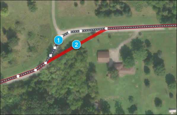
The centerline features for the route must exist before applying cartographic realignment.
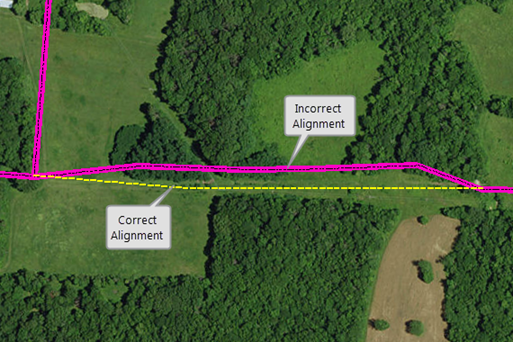
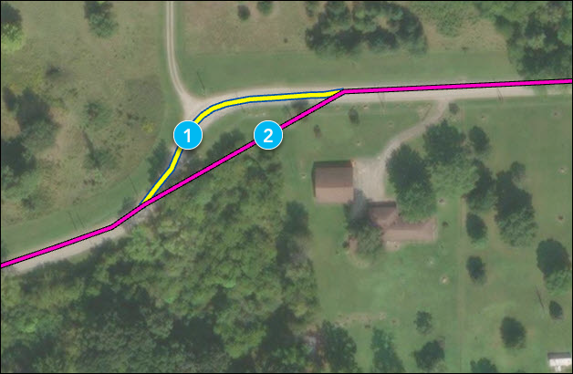
The numbers in the image above correspond to the numbers in the following table:
Component Description 
Correct alignment 
Incorrect alignment In the Contents pane, on the List By Selection tab
 , in the Selection list, uncheck the network layer.
In the Contents pane, on the List By Selection tab
, in the Selection list, check the centerline layer.Select the centerline feature in the map for editing.
Use the Edit Vertices tool to edit feature vertices and modify centerline segments as necessary.
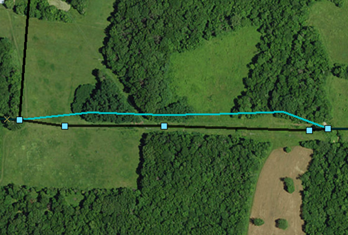
The numbers in the image above correspond to the numbers in the following table:
Component Description Updated centerline Original centerline After editing the vertices to match the proposed alignment of the route, right-click anywhere on the map, and click Finish
 .
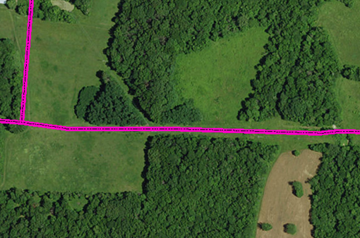
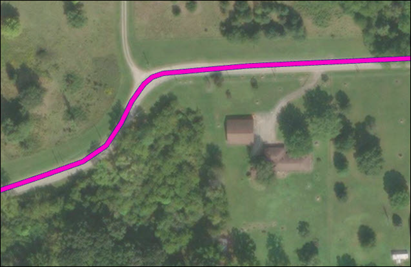
The route is cartographically realigned.
Vertices on the route are impacted by the cartographic realignment based on the configured cartographic realignment option.
Note:
If a message about acquiring locks appears, it means that conflict prevention is enabled. After you select a route, the tool attempts to release the route lock if the active user acquires the route lock in a different named version and the releasable status value is Yes.
If conflict prevention is enabled, locks are acquired on all routes associated with the centerline being edited.
When you update centerline features, the route geometry in all routes in all networks, across all times, are modified accordingly. However, the event geometry for events and locations of the managed intersections are not updated until you run the Apply Event Behaviors and Generate Intersections tools.
Learn more about scenarios for generating and updating intersections
Complex route cartographic realignment scenarios
Scenarios for complex route cartographic realignment on loop and lollipop routes when the Update route measures in cartographic realignment property is set to No are described below.
Cartographic realignment on a loop
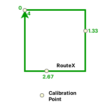
In the following example, an undershoot is fixed on a loop route that has a start measure of 0 and an end measure of 4 before cartographic realignment:
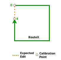
After cartographic realignment, the undershoot on the loop is fixed and two intermediate calibration points are added at measures 1.33 and 2.67:
Note:
If the Update route measures in cartographic realignment property is set to No, then existing intermediate calibration points will have updated measures to account for the shape change. If this property is set to Yes, only calibration points upstream of the cartographic realignment have their measures changed.
In the example above, the location of the intermediate calibration points stays the same, but their measures can change.
Cartographic realignment on a lollipop
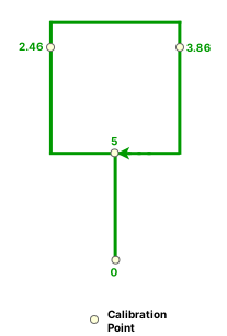
In the following example, an undershoot is fixed on a lollipop route that has a start measure of 0 and an end measure of 5 before cartographic realignment:
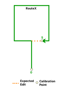
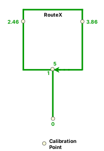
After cartographic realignment when the Update route measures in cartographic realignment is set to No, the undershoot on the lollipop is fixed and two intermediate calibration points are added at measures 2.46 and 3.86:
In the following example, an overshoot is fixed on a lollipop route that has a start measure of 0 and an end measure of 5 before cartographic realignment:
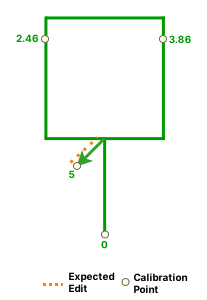
After cartographic realignment when the Update route measures in cartographic realignment property is set to No, the overshoot on the lollipop is fixed: