分类 LAS 地面点 (3D Analyst 工具)

汇总

LAS 数据中的地面点。

了解有关地面分类的详细信息

插图

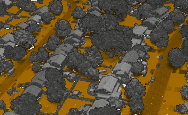
“分类 LAS 地面点”工具图示

用法

  • 此工具要求输入 LAS 数据集具有投影坐标系。 通过将 提取 LAS 工具与输出坐标系环境设置中指定的投影坐标系结合使用,可以对地理坐标系中存储的数据进行重新投影。 如果投影坐标系基于不同的基准面,则应指定基准面变换。

  • 只有类别代码值为 0、1 或 2 的 LAS 点可以被分配为地面点。 如果您的 LAS 文件使用不同的类代码值来表示未分类或地面测量值,请使用 更改 LAS 类代码 工具对其进行相应的重新分配。 分类过程还将忽略分配有重叠或保留分类标记的点。

  • 标准分类方法通常能满足大多数数据集的地面点检测需求。 如果检测到的地面点中包含较多非地面点,建议使用保守分类方法来减少这种误差。 相反,如果数据集中包含具有陡坡要素的崎岖地形,且可能被植被部分遮挡,建议采用激进分类方法,以捕捉更多的地面点。 若使用该选项后仍有部分山脊未被识别,可通过空间范围或面边界划定改进区域,并启用恢复山脊选项重新运行工具。

  • 由于带有桥梁和高速公路入口匝道的位置可能会被错误分类为地面,因此应对这些位置进行检查。 要纠正这些区域,建议应用处理范围或边界,隔离错误分类区域及其周围的部分地形,然后再次运行工具。 隔离的区域应尽量避开桥梁或匝道与地面连接的部分。

  • 如果您需要比正常数据集处理时间更快地获取地面分类结果,可以使用 DEM 分辨率参数。 该参数可确保分类地面点的数量足以生成指定分辨率的地面栅格表面,但分类地面点数量将少于常规处理。

  • 对模型关键点进行分类将得到一个地面点子集,可用于替代全分辨率地面点。 当地面样本密度高于给定应用所需密度时,这将非常有用。 与提供快速地面分类方法的 DEM 分辨率参数不同,对模型关键点进行分类可以更完整地分类地面点,并提供一个可用于下游操作(例如创建高程栅格表面)的子集。 在 LAS 文件版本 1.0 中,模型关键点将被分配类代码值 8;在所有其他 LAS 文件版本中,模型关键点将保留类代码值 2,但会分配模型关键点分类标志。

    了解关于如何使用激光雷达创建地面高程栅格的详细信息

  • 标记为保留或重叠的点将被忽略。 保留点最初被定义为不用于分类。 重叠点在处理过程中被忽略,因为包含它们会造成点密度的剧烈波动,并且它们还可能在航线之间引入与噪点相关的校准问题。

参数

标注 说明 数据类型

输入 LAS 数据集

将要处理的 LAS 数据集。 仅评估类代码值为 0、1 和 2 的 LAS 点的最后回波。

LAS Dataset Layer

地面检测方法

指定将用于检测地面点的方法。

  • Standard ClassificationThis method has a tolerance for slope variation that allows it to capture gradual undulations in the ground's topography that would typically be missed by the Conservative Classification option but not capture the type of sharp reliefs that would be captured by the Aggressive Classification option. This is the default.

  • Conservative ClassificationWhen compared to other options, this method uses a tighter restriction on the variation of the ground's slope that allows it to differentiate the ground from low-lying vegetation such as grass and shrubbery. It is best suited for topography with minimal curvature.

  • Aggressive ClassificationThis method detects ground areas with sharper reliefs, such as ridges and hilltops, that may be ignored by the Standard Classification option. This method is best used in a second iteration of this tool with the Reuse existing ground parameter checked. Avoid using this method in urban areas or flat, rural areas, as it may result in the misclassification of taller objects—such as utility towers, vegetation, and portions of buildings—as ground.

  • Recover RidgesThis method detects ridges that may be undetected by the Aggressive Classification option. A processing extent or boundary polygon must be provided to use this method.

  • Model Key ClassificationThis method classifies a subset of existing ground points as model key. For this reason, the ground points must already be classified. This option provides a faster way to achieve model key classification instead of reclassifying all the ground points. In LAS versions 1.0 to 1.3, the ground points that are identified as model key will be assigned a class code value of 7. LAS version 1.4 files will maintain the ground class code of 2 and have the model key classification flag assigned.

String

重用现有地面

(可选)

指定现有地面点是否会重新分类或重新使用。

  • 选中Existing ground points will be accepted and reused without scrutiny and contribute to the determination of unclassified points.

  • 未选中Existing ground points will be reclassified. Points that are not found to be a part of the ground will be reassigned a class code value of 1, which represents unclassified points. This is the default.

Boolean

DEM 分辨率

(可选)

将导致仅评估分类为地面的点子集,从而加快分类过程的距离。 需要更迅速地生成 DEM 表面时可考虑使用该参数。 最小距离为 0.3 米,但提供的距离必须至少为激光雷达数据平均点间距的 1.5 倍,否则该过程将无法生效。

Linear Unit

计算统计数据

(可选)

指定是否将计算 LAS 数据集引用的 .las 文件的统计数据。 计算统计数据时会为每个 .las 文件提供一个空间索引,从而提高了分析和显示性能。 统计数据还可通过将 LAS 属性(如分类代码和回波信息)显示限制为 .las 文件中存在的值来提升过滤和符号系统体验。

  • 选中Statistics will be computed. This is the default.

  • 未选中Statistics will not be computed.

Boolean

处理范围

(可选)

将评估的数据范围。

  • 当前显示范围 地图视图 - 范围基于活动地图或场景。

  • 绘制范围 构造直角并完成草图 - 范围将基于在地图或场景上绘制的矩形。

  • 图层范围 图层 - 范围基于活动地图图层。 选择可用图层或者使用所有图层中的数据范围选项。 每个地图图层具有以下选项:

    • 所有要素 全选 - 所有要素的范围。

    • 选定要素 选定要素的区域 - 选定要素的范围。

    • 可见要素 范围指示器 - 可见要素的范围。

  • 浏览 浏览 - 范围将基于数据集。

  • 输入的交集 相交 - 范围将为所有输入的相交范围。

  • 输入的并集 联合 - 范围将为所有输入的合并范围。

  • 剪贴板 粘贴 - 可在剪贴板中复制和粘贴范围。

    • 复制范围 复制 - 将范围坐标和坐标系复制到剪贴板。

    • 粘贴范围 粘贴 - 从剪贴板粘贴范围和坐标系。 如果剪贴板不包含坐标系,则范围将使用地图的坐标系。

  • 重置范围 重置 - 将范围重置为默认值。

当手动提供坐标时,坐标必须为数值,并且位于活动地图的坐标系中。 地图可能使用与提供的坐标不同的显示单位。 在南纬和西经坐标中使用负号。

Extent

处理边界

将定义待处理区域的一个或多个面要素。

Feature Layer

处理与范围相交的整个 LAS 文件

(可选)

指定处理范围的应用方式。

  • 选中If any portion of a .las file intersects the area of interest, all the points in that file, including those outside the area of interest, will be processed.

  • 未选中Only LAS points that intersect the area of interest will be processed. This is the default.

Boolean

更新金字塔

(可选)

指定在修改类代码后是否更新 LAS 数据集金字塔。

  • 选中The LAS dataset pyramid will be updated. This is the default.

  • 未选中The LAS dataset pyramid will not be updated.

Boolean

检测算法

(可选)

指定将用于对地面点进行分类的地面检测算法的版本。

  • LatestThe most recent version of the ground detection algorithm will be used. This option improves the handling of noise and outlier points, especially for photogrammetrically derived point clouds. It also produces better results and faster performance in most cases. This is the default.

  • First GenerationThe initial version of the ground detection algorithm will be used. Use this option only when the results from the latest version are not suitable.

String

分类低噪点

(可选)

指定是否将低于地面以下给定距离的点分类为低噪声点。 识别噪声点的距离基于地下深度下限参数值。 将为低噪声点分配类代码值 7。

  • 选中Low-noise points will be classified.

  • 未选中Low-noise points will not be classified. This is the default.

Boolean

地下深度下限

(可选)

将用于对低噪声点进行分类的地面以下距离。 将由根据地面分类点创建的三角化表面来定义地面。 对于类代码为 0 或 1 且低于地面达到此参数中提供的高度的所有点,将为其分配类代码值 7。

Linear Unit

保留现有低噪点

(可选)

指定是将保留类代码为 7 的现有低噪声点,还是对其进行重新分类。 如果对低噪声点进行重新分类,则对于任何未低于地面至少为地下深度下限参数值提供的距离的点,将为其分配类代码值 1。

  • 选中Existing low-noise points will be preserved. This is the default.

  • 未选中Existing low-noise points will be reclassified.

Boolean

分类高噪点

(可选)

指定是否将高于地面给定距离的点分类为高噪声点。 识别噪声点的距离基于地上高度下限参数值。 将为高噪声点分配类代码值 18。

  • 选中High-noise points will be classified.

  • 未选中High-noise points will not be classified. This is the default.

Boolean

地上高度下限

(可选)

将用于分类高噪声点的地上距离。 将由根据地面分类点创建的三角化表面来定义地面。 对于类代码为 0 或 1 且高于地面达到此参数中提供的高度的所有点,将为其分配类代码值 18。

Linear Unit

保留现有高噪点

(可选)

指定是将保留类代码为 18 的现有高噪声点,还是对其进行重新分类。 如果高噪点被重新分类,任何未高于地上高度下限参数规定距离的点将被赋予类别代码值 1。

  • 选中Existing high-noise points will be preserved. This is the default.

  • 未选中Existing high-noise points will be reclassified.

Boolean

分类模型关键点

(可选)

指定是否将模型关键点与地面点一起分类。

当选中此参数时,LAS 文件版本 1.0 中的模型关键点将被分配类代码值 8,并且所有其他 LAS 文件版本中的模型关键点将保留类代码 2,但会分配模型关键点分类标志。 当地面检测方法参数值为模型关键点分类时,将强制执行此选项。

  • 选中Model-key points will be classified.

  • 未选中Model-key points will not be classified. This is the default.

Boolean

分类类型

(可选)

指定用于对模型关键点进行分类的方法。

  • Z ToleranceModel-key points will be selected to ensure that the TIN surface derived from the model-key points is within a given height range of the TIN surface derived from the complete set of ground points. This is the default.

  • Window SizeModel-key points will be derived using the window-size thinning method, where the data is divided into a grid whose resolution is set by the Window Size parameter value. Each grid will have one ground point selected based on the option specified for the Window Size Point Selection Method parameter.

String

Z 容差

(可选)

由模型关键点创建的 TIN 表面与由完整地面点集创建的 TIN 表面之间允许的最大高度偏差。 参数值越大,模型关键点的数量就越少。

Linear Unit

窗口大小

(可选)

窗口大小子采样技术将使用的分辨率。

分类类型参数值为 Z 容差时,窗口大小将用于确保实现最小样本密度,这可以避免在数据中创建可能导致某些类型分析出现问题的大间隙。 要忽略此过程,请将该参数留空或提供一个小于或等于 0.0 的值。

Linear Unit

窗口大小点选择方法

(可选)

指定在使用窗口大小方法时用于选择地面点子集的高度标准。 窗口大小子采样技术的每个图格将有一个点。 与所选方法对应的点将用于模型关键点的检测。

  • AverageThe point whose z-value is closest to the average of all points in the window size bin will be used. This is the default.

  • MaximumThe point with the highest z-value in the window size bin will be used.

  • MinimumThe point with the lowest z-value in the window size bin will be used.

String

派生输出

标注 说明 数据类型

输出 LAS 数据集

已修改的 LAS 数据集。 在 LAS 版本 1.0 到 1.3 中,被识别为模型关键点的地面点将被分配类代码值 7。 LAS 版本 1.4 文件将保留地面类代码 2,并分配模型关键点分类标志。

LAS Dataset Layer

环境

当前工作空间, 临时工作空间, 范围

许可信息

  • 基本: 需要 3D Analyst
  • 标准: 需要 3D Analyst
  • 高级: 需要 3D Analyst