Supported map projections
The following table contains the name of every map projection included in ArcGIS Pro, along with a representative image and a description. Each map projection name is a link to a detailed page that describes the properties and uses of that map projection.
Download a poster that compares all the map projections.
| Map projection | Example |
Description |
|---|---|---|
| Adams square II | 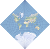 |
This projection shows the world in a square. It is a conformal projection except in the four corners of the square. |
| Aitoff |  |
This compromise modified azimuthal projection takes the form of an ellipse. It is used primarily for world maps. |
| Albers | 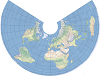 |
This equal-area conic projection is best suited for land masses extending in an east-to-west orientation at mid-latitudes. |
| Aspect-adaptive cylindrical | 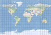 |
This compromise map projection adjusts the parallels to the height-to-width (aspect) ratio of a canvas. The aspect ratio must be between 0.3 and 1. |
| Azimuthal equidistant | 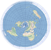 |
The projection preserves both distance and direction from the central point. It is used primarily for hemisphere maps. |
| Behrmann | 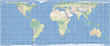 |
This is a cylindrical equal-area projection with standard parallels at 30° north and south. |
| Berghaus star | 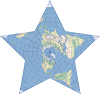 |
This interrupted projection takes a form of a star, and it is used by the American Association of Geographers (AAG) in their logo. |
| Bonne | 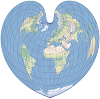 |
This equal-area projection was historically used to map continents. Its graticule takes the form of a heart. |
| Cassini |  |
This transverse cylindrical equidistant projection is appropriate for large-scale maps with predominantly north-to-south extent. |
| Compact Miller | 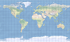 |
This compromise cylindrical world map projection compresses polar areas in comparison to the Miller projection. |
| Craster parabolic |  |
This pseudocylindrical equal-area projection is primarily used for thematic maps of the world. |
| Cube | 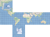 |
This is a faceted projection consisting of six square sides that can be folded into a cube. |
| Cylindrical equal area |  |
This projection maintains the relative area on a map and presents the world as a rectangle. |
| Double stereographic | 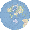 |
This azimuthal projection is conformal and used for large-scale coordinate systems in New Brunswick and the Netherlands. |
| Eckert I |  |
This compromise pseudocylindrical projection is primarily used as a novelty map. |
| Eckert II |  |
This equal area pseudocylindrical projection is primarily used as a novelty map. |
| Eckert III |  |
This is a compromise pseudocylindrical map projection used for general world maps. |
| Eckert IV |  |
This equal-area pseudocylindrical map projection is commonly used for thematic and other world maps requiring accurate areas. |
| Eckert V |  |
This is a compromise pseudocylindrical map projection used for general world maps. |
| Eckert VI |  |
This equal-area projection is used primarily for thematic world maps. |
| Eckert-Greifendorff |  |
This equal-area projection is a modification of the Lambert azimuthal equal-area projection. |
| Equal Earth |  |
This equal-area pseudocylindrical projection has a pleasing appearance for land features and is used for thematic world maps. |
| Equidistant conic |  |
This conic projection preserves distances along all meridians and two standard parallels and is best suited for areas extending east to west at mid-latitudes. |
| Equidistant cylindrical | 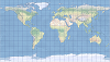 |
This projection forms a grid of equal rectangles. It is also known as equirectangular, simple cylindrical, rectangular, and plate carrée. |
| Fuller |  |
This projection is an unfolded 20-sided icosahedron that keeps the land masses unbroken. |
| Gall stereographic | 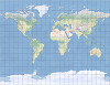 |
This perspective cylindrical map projection has two standard parallels at 45°N and 45°S and exaggerates polar regions. |
| Gauss-Krüger |  |
The ellipsoidal form of the transverse Mercator, conformal but not direction-preserving. |
| Geostationary satellite | 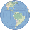 |
Used by geostationary satellites, based on satellite scanning angles. |
| Gnomonic | 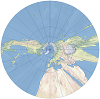 |
Projects great circles as straight lines—useful for navigation. |
| Goode homolosine |  |
An equal-area hybrid of Mollweide and sinusoidal, often interrupted. |
| Hammer |  |
A modification of the Lambert azimuthal equal-area; also known as Hammer–Aitoff. |
| Hotine oblique Mercator | 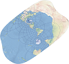 |
Oblique orientation Mercator projection for conformal mapping of oblique regions. |
| IGAC plano cartesiano | 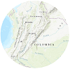 |
Used for urban maps in Colombia; supports only very large scales. |
| Krovak | 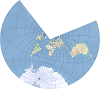 |
Oblique Lambert conformal conic, designed for Czechoslovakia. |
| Laborde oblique Mercator | 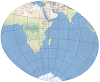 |
Jean Laborde’s oblique Mercator projection for conformal mapping of oblique areas. |
| Lambert azimuthal equal-area | 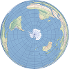 |
Preserves relative area; suited for hemisphere and polar maps. |
| Lambert conformal conic | 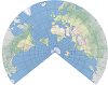 |
Best for mid-latitude, east–west–oriented land masses; conformal. |
| Local | 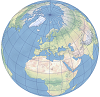 |
A specialized projection ignoring Earth curvature—used for very large-scale local systems. |
| Loximuthal |  |
Shows loxodromes (constant bearing lines) as straight lines with correct azimuth from a reference point. |
| McBryde-Thomas flat-polar quartic |  |
An equal-area projection suited to thematic world maps. |
| Mercator | 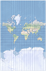 |
Conformal cylindrical projection preserving local shape; excellent for navigation. |
| Miller cylindrical | 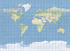 |
Similar to Mercator but with reduced polar distortion. |
| Mollweide |  |
Equal-area elliptical projection (2:1 ellipse), common for thematic small-scale maps. |
| Natural Earth |  |
A compromise pseudocylindrical projection optimized for physical data. |
| Natural Earth II |  |
A compromise pseudocylindrical projection with meridians curving steeply toward the poles. |
| New Zealand National Grid | 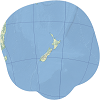 |
Standard projection for detailed mapping of New Zealand. |
| Ney modified | 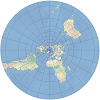 |
Modified Lambert conformal conic for mapping polar-adjacent areas. |
| Orthographic | 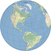 |
Perspective projection from infinite distance; resembles a 3D globe. |
| Patterson | 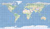 |
Tom Patterson’s 2014 compromise cylindrical projection. |
| Peirce quincuncial | 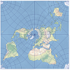 |
Conformal except at midpoints of square sides; world shown in a square. |
| Perspective cylindrical | 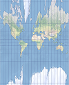 |
A geometrically constructible cylindrical projection; includes the central cylindrical. |
| Plate carrée |  |
A simple grid of equal squares; commonly used to display geographic coordinates. |
| Polyconic | 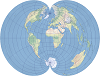 |
"Many-cone" projection method—historically common for continental maps. |
| Quartic authalic map |  |
Equal-area pseudocylindrical projection for thematic world maps. |
| Rectified skewed orthomorphic | |
Oblique Mercator variant by Hotine; used in Malaysia and Brunei. |
| Robinson |  |
A compromise world map projection balancing distortions pleasingly. |
| Sinusoidal |  |
Equal-area pseudocylindrical projection with true-length parallels and central meridian. |
| Stereographic | 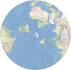 |
Conformal azimuthal projection; used for polar and large-scale mapping. |
| Times | 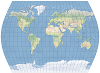 |
Compromise pseudocylindrical; modified Gall stereographic with curved meridians. |
| Tobler cylindrical I | 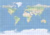 |
Waldo Tobler’s 1997 compromise cylindrical projection (first version). |
| Tobler cylindrical II | 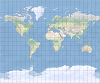 |
Tobler’s second 1997 compromise cylindrical alternative to Miller. |
| Transverse cylindrical equal-area |  |
The transverse form of the cylindrical equal-area projection; best for N–S regions. |
| Transverse Mercator | 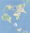 |
Conformal cylinder tangent at a meridian; used for large-scale mapping. |
| Two-point equidistant | 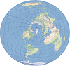 |
Shows true distance from two selected points to any other point. |
| Van der Grinten I | 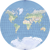 |
Compromise polyconic projection portraying the world as a circle. |
| Vertical near-side perspective | 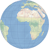 |
Perspective from finite height; resembles a satellite view. |
| Wagner IV |  |
Equal-area pseudocylindrical projection for thematic world maps. |
| Wagner V |  |
Compromise pseudocylindrical projection for world maps. |
| Wagner VII |  |
Equal-area Hammer-Wagner variant for world thematic maps. |
| Winkel I | 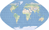 |
A pseudocylindrical average of equidistant cylindrical and sinusoidal. |
| Winkel II | 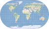 |
A pseudocylindrical average of equidistant cylindrical and Mollweide. |
| Winkel Tripel | 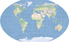 |
Compromise projection averaging equidistant cylindrical and Aitoff; used by National Geographic. |